We are stalled on starting our journey with Lexy at the repair shop. Soon, hopefully soon, we will hit the road!
Finally!!
We have Lexy back, and can't wait to get this trip going. It seems Porthos is now taking all the packing activity in stride. He used to follow us everywhere, knowing that something was up. Now he perches at the top of the steps to the playroom and watches all the commotion from on high.
4/8/22: Our first night out, heading for Joshua Tree. We took highway 138 out to Lancaster to avoid going through LA. And, we took the chance to see if the desert is blooming. Lots of poppies everywhere!
Quick In and Out stop in Palmdale for dinner. Best lettuce wraps ever! And the fries are great too.
We are camping on the south entrance at the BLM dispersed camping area.
4/9/22: In the morning, we woke to this soft breeze, and have been luxuriating in it, not really ready to leave this heavenly spot.

But alas, we've got places to go and people t see! We had visited Joshua tree last year so we were not including it in this trek. So after a spell, we headed east on I-10, desitination: Phonix AZ. If you have visited this section of highway recently, you will be thrilled that they are actually working to replace large sctions of this road. It is just a washerboard of a road right now! My teeth ar still rattling from it.
Just a few miles east of Joshua Tree is the General Patton Memorial, at Chiriaco Summit. There is a nice museum, and a tank exhibit, and a nice bronze statute of General. Patton too.
There is a remembrane wall too. It's definitely a place to stop if you have the time.
Onward. We are traveling in a bit of a heat wave, and we're expecting the temperature in Phoenix to about 96 degrees. I think this might be one reason we're not in a hurry; the van's air conitioner works just fine while we're driving along so why get to Phoenix before the evening breezes move in to cool off the place?!
We pulled off the highway again at Quartzite just to see the lay of the land there. This is an interesting place, where from January through April every year, it becomes a mecca for RVers. It was nicely highlighted in the recent movie Nomadland. We pulled off I-10 at exit 17 and pulled into Daniel's Really Good Fresh Jerky store. Delightful!
Additional to the dozens of fabulous jerky flavors they produced, they also prided themselves on carrying just about every "boutique" hot sauce brand produced in the Southwest. The labels and names were very entertaining, such as Dr. Assburn's Ghost Sauce, and others just as colorful and descriptive.
And I mean every brand. Just look at the inventory....
We skipped the hot sauce, but indulged in some garlic rosemary brisket jerky, plus an ahi tuna and lemon pepper beef. Delicious!
We talked with the shopkeeper, who gave us the lay of the land, how the town was about to go into hibernation mode because all the RVrs that were visiting had left early on account of the gas prices going up so fast. Everyone was afraid they wouldn't be able to get home if the prices kept rising. So, the RV season was ending a few weeks early. We then drove around town, tuning into the local radio station, which was playing cool music and the ads were for the shops we were passing by right then on the street as we heard the ads. It was a "Mayberry" feeling, like we were visiting the tiny town and hearing about its features that we were experiencing on the radio. Quaint! We then went into a gem shop that was huge. If you can imagine a store the size of a Home Depot building, filled with rocks, gems, chrystals, beads, fossils, just about anyting pretty that came from the ground. I must say, I carried more than one stone around the store, feeling it become part of my hand, but then I put each one back because if I were to buy one, I would have slipped down a very slippery slope and would have picked up a cart and curated dozens of stones that I couldn't live without! Incredible prices on everything too! A 12-pack of beautiful blue agate slices for $15. I was ready to pick out a set of 9-in slices to use as dinner plates, wouldn't that have been absolutely stunning! But, no more dishes, no more rocks! We have so many, and we're just starting on our journey; I don't want to carry too many things around for the next few weeks.
We finally pulled into the campground where we were staying for the night, at Lake Pleasant, in the Desert Tortouis campground. This is a really lovely park, run by the Maricopa regional parks service. They designed it so well, it was really beautiful and well laid-out.
It was a Saturday night, so the place was absolutely hopping. Lots of people congregating, loud music, you get the picture. We are just 45 miles from Phoenix, so on a warm spring weekend, Lake Pleasant was the place to be! Well, despite the crowds, we really loved the park. Our campsite was so nice, and they had electric and water hookups, so it was just cushy for us!
Being it so warm, we slept with the van's back doors open. we just installed the screens, so it was a treat to put them to use.
Through the evening, we heard tons of birds including owls, doves, quail, and others whose songs we couldn't identify. Then at 1am, we heard wild burro's making their way down the road, and one of them let out a deafening call, oh my gosh, it was so loud! Then shortly after, a pack of coyotes all started howling for just about 3 minutes. Then about 3am, Porthos kept waking us up by barking. I looked outside our camper and couldn't see anything. But Porthos persisted for another 20 minutes. In the morning we figured that we were invaded by a pack of raccoons, because one of our neighbors' garbage was not-so-neatly spread all around their campsite. I have to wonder if the raccoons were the least bit tempted to climb into our van, with the back doors wide open. The screens stay closed by magnets. Raccoons can handle zippers, so magnets would have been even easier! Thank goodness they weren't tempted. Maybe we have Porthos to thank for that!
4/10/22: Next morning, we got up somewhat early because we had to get across town for an 8am entrance ticket to the Desert Botanical Gardens, just east of downtown Phoenix. We are so excited to see the Chihuly glass-art exhibit that is currently housed there thoughout the gardens. The weather promises to be just slightly cooler, around 90 degees. And, perfectly planned, they allow visitors to bring their dogs in the gardens on Sundays. Fabulous! We noticd that there might be almost as many dogs as people here! All well-behaved, including our Porthos, thank Goodness. And oh my the gardens are spectacular. We were mesmorized by both the gardens and the glassoworks, as the landscape design was so exquisite that you had a spectacular view no matter were you were standing. And as soon as you took five steps, the view changed ever so slightly, but it was again like as if it was the best view. I took SO many pictures.
This was the first display, greeting you at the entrance.
I stared at this sculpture for some time. it just drew me in.
The indoor glassworks exhibit was just as spectacular.
And, the live plants get honorable mention here too!
We could have stayed all day, visiting the entire gardens over and over. But for the heat, we were limited to just 3.5 hours and I think we did well to stay that long. Porthos was also in heaven, having so many dogs to meet and greet, and enough hydration stations to keep him happy.
Alas, time to leave the sweltering heat of Phoenix and move northward to Sedona.
We headed north on I-17 and took in the desert flora along the route. Our elevation was climbing slowly, and thankfully the heat was lifting a bit. When we got to Sedona, it was a balmy 80 dgrees. And oh my, it is so beautiful.
Being it was getting late, we decided to find a camping spot. Heading up the canyon on 89A, we discovered that the one and only campground that was open was small and for tents only, and it was full. So, we talked with a ranger at the Slide Rock Stat Park, who told us about some dispersed camping areas out west of town. So, we headed out, just past FS525, and found a Fish & Game area that allowd boondocking. Very nice!
We made dinner and watched the sun set, and planned out our visit in Sedona.

4/11/22: Next day, we had a nice breakfast, as I expected that we would be hiking all day in the glorious mesa's and canyons of Sedona. We then drove across the way on the roads less traveled, from Lolomai Rd to the south side of town, to see the Sedona/Coconino Forest Visitors' Center, which is really nice. Then, we headed for Bell Rock, to get some vortex energy. And here's where we learned a thing or two about Sedona that I really must share. Sedona is so absolutely gob-smackingly gorgeous, with eroded vertical red cliffs and hoodoo's at every turn. And, it is a spiritual center, a mecca for anyone trying to tune in to the spirit of the eath and sky, with the vortices located around close to town. It's no wonder that the place was packed with visitors. I mean, it is a royal zoo. We spent over a half hour just trying to get back out of the parking area for hiking near the Bell Rock trailheads., and I thought, maybe everyone is hiking, so maybe nobody is visiting the Chapel of the Holy Cross. How naiive of me. Another hour trying to get a spot to park anywhere near the chapel, and I was ready to skip this town altogether. We had another vortex point to visit, at the Airport Mesa, and hopefully we could park there. Miraculously, there was a spot right in front of the trailhead, so we grabbed it. And sweet relief, the energy pulled me right up the bluff, and I felt I was bathing in the sweetness of it all.
And, what a view!
We then drove out to Boynton Canyon for yet another dose of vortex energy. Again, the parking was impossible in the area closest to the canyon, so we went just a little south to the Aerie trailhead, just to the west. One sign of being in or near a vortex is that the bark on the juniper trees is all twisted. It seemed that we were on track, by the looks of the trees here.
And of course, it's nice when you can actually feel something. I always feel a slight vibration, like on a cellular level, and I feel very light on my feet. Vortex energy is describd as a high concentration of negative ions released from certain spots. That makes sense. Whatever it is, it's wonderful!
So, here's the solution for the crowds: for each day we were in Sedona, we would pick one of our top destinations, and get there at 8am. So, tomorrow morning, we're heading straight for the chapel. Well, the gates open at 9am, so we'll park just outside the gates at 8am and walk up the hill when they open.
In the meantime, we have to find a place to camp for the night. I just can't believe that there are only three campgrounds in the entire Sedona area, and two are still closed for the season. Off to boondocking again tonight. We head up FS525, which is a popular dispersed camping area. We find a good area, and thankfully, it's still just light enough to scope out our spot.
4/12/22: In the morning, we had a little trouble with the embankment getting back on the dirt road, and bottomed out the van, crunching our waste disposal pipe. Yikes! Thank goodness the black and gray gate valves and the pipes to the holding tanks were intact, but the dump pipe outlet was broken. Bummer. Well, there were no dump stations in Sedona anyway, so we figured we'd finish our sight-seeing, then head north to Flagstaff to do some RV repair work. On to the chapel.
Reverant, mighty, but humble at the same time, this little church is a must-see if you have any inkling for prayer or meditation.
We just sat in awe of the beauty of this place. And it seemed God was whispering a message to me while there. "Just be."
Since Bell Rock was near the Chapel, we decided to try this spot again for hiking.
But no luck; the parking lot was impacted with cars lining up in the street to get in. So, with the rv repairs a bit heavy on our minds, we headed north, up the canyon to Flagstaff.
We found this great RV shop, called RV Country, and they had the replacement part we needed. Yay! But, first, empty the tanks. We used a ton of duct tape to wrap up the broken pipe and went to a Speedy gas station who also had a dump station. And it worked, the duct-tape held. Phew! We were pretty worried how bad that could have turned out. Then we headed to a vacant lot to start our repair. But, a cold front had moved in, and we're working under the van with a 30-mile wind hitting us, and the temperature dropping to 38 degrees. Our fingers were freezing off! And, we got the new part put on, all but one connecting screw, and we just couldn't get it to fit. Finally after trying for 2 hours, we packed it in. We found a KOA with hot showers and electricity in Flagstaff, and worked on thawing out; we were frozen to the bone! Back at RV Country, they had a service shop too, so they were able to fit us in the next day to complete the installation. They were an absolute godsend!
While in Flagstaff, we came across a tamale shop, quite by accident, that earns mention here. We were actually looking for Tres Amigos food truck on Fourth St for tacos, but they were not to be found. But, instead, we saw the little shop called Tortilla Lady/RisingHy. They make tamales and specialty salsas onsite, and serve take-out only. We indulged in some radically delicious tamales for dinner! I noticed they had a website RisingHy.com. Maybe they can ship us some at home. Yumm!
4/13/22: And we're off, pipes again intact, and heading east on I-40/Route 66 to the Homolovi State Park, in Winslow, AZ. This is an active archieological site of four ancient Hopi settlements. Fascinating!
And, the campground is so tidy and pristine, We decided to stay an extra night here, so we'd have all day to check out the ruins here.
And, what a change of pace; it seems that we are the only ones in the entire park.
4/14/22: On one short hike, we found some pictograms. Score!
Onward to Painted Desert/Petrified Forest. First, a quick trip into Winslow to take care of taxes. The only place to make a print from a pdf file is at the library. And what a quaint library it was! As was the Post Office! Historic Route 66 runs right down the center of town, with easterly going one way up Rairoad(?) street, and westerly going one way a block north of the easterly lanes, on Main street. On the easterly direction, there are a lot of shops and signs celebrating the historic route. Not so much on the westerly street, so if you get into town, be sure to go around the block to see the easterly street. It's a hoot!
We stoppd to get gas in Holbrook, and on to Painted Desert. The national park includes the Petrified Forest, so the one visitor center north of the highway was our destination. Once inside, we were in awe of the scenery, at the first viewing turn-out inside the park.
Layers of rock, forming striations in the surface colors, just beautiful.
We stopped in at the historic Desert Inn. It was originally built from petrified wood agate blocks, but they transformed it to pueblo architecture recently. It is still a stunning place!
The interior lobby has been preserved, so you see it as th travelers did 100 years ago.
The Park Drive crosses the historic Route 66, parallel to highway 40.
Someone parked their Studebaker here some time ago.
Continuing in the park, south of i-40, we stop to see anasazi settlements, with petroglyphs nearby. It is starting to be easy to feel as if we were back in time, with so much of the Anasazi life recorded in the ruins.
We went as far south as Newspaper Rock, and then realized the park was closing. So, we headed back to the north entrance (the park has one main road spanning from the Painted Desert sites in the north, for 24 miles to the Petrified Forest in the south, with controlled access into/out of the park only at the north and south entrances). Time to find a place to camp! I found Desert Skies, a "hipcamp" owned by Jason, just east of Holbrook. It was basically Jason's front acreage of his lot with cleared flat spots for travelers to park for $20 per night. No water or power, but he had put up a number of glamping tents and built fire pits. Jason was very friendly and accommodating, and told us about the camp as his work in progress. He introduced us to his Basset Hounds (he breeds them) and his little pig called Rooty.
Porthos thought the Basset Hound Club was a kick, but wasn't sure about Rooty.
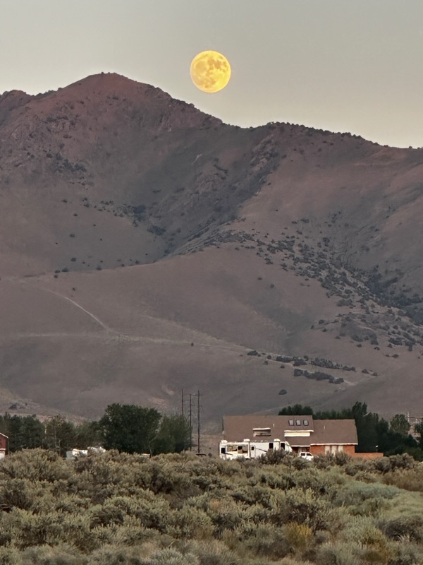
A nice night in the desert, under a full moon. I might have preferred a new moon, because the stars would have been spectacular here!
4/15/22: In the morning, we went back to Holbrook for propane, and our resistance broke down and we went into a rock store. Check it out if you're in town, Jim Gray's Petriied Wood Company.
We were bedazzled, to say the least. And, this was great timing, because we were about to go back to the Petrified Forest to see the southern half of the national park, so we learned a lot about petrified wood from the shopkeeper.
The shop had amazing pieces. And of course, all the petrified wood at this shop was from land outside the national park, we were told. This whole area east of Holbrook is riddled with specimens of petrified wood sitting on the surface of the land. As we headed back into the park, we noticd that no matter where you look, there are petrified logs laying on the surface.
We hiked to the "Agate House", which was a pueblo that was reconstructed from its original building material, petrified wood.
At first you feel aghast, how could anyone pick up such rare and even sacred rocks and use them to build a house? But then you see that the petrified wood is everywhere, just everywhere, and funny enough, it's the only kind of rock that you can find lying around this area. So, I suppose, if you were going to build something, use what's available, even if your house looks a little bit over-dressed.
This park is astounding! I feel like I'm walking through a land where emeralds flow in the river and rubies grow on the trees. Beautiful rocks are everywhere! Some are still the full intact tree lying where it originally fell.
Our last stop in the park was the Keystone Bridge site, which was a mile loop trail that was spectacular! Walking through the hills, it was exhilerating, we felt as if we were part of this land.
What a beautiful park. Even dog-friendly to boot.
Hitting the road, we head north, for our next destination, Canyon DeChelly.
The wind as so swift on highway 191 north, that I was white-knuckled and I was having trouble unwrapping my fingers from the wheel once we reached Chinle. There was a lot of sand and dust in the air, and we were slow to close our cab windows before everything had a layer of sand on it in the van. Lesson learned!
We headed to Spider Rock campground, and checked in with Howard, the camp host. The campground was really nice visually, but there is no running water (water is trucked in) and the restrooms were in disrepair. But Howard was great, and we were all set for dry camping, so all was fine. We met a neat couple, Eric and Renee who were traveling with their dog through Arizona and Utah (fantastic Road Trip!). We shared some of our favorite dispersed camping sites with them that will come in handy on their journey. All the Best, Eric and Renee!
4/16/22: In the morning, we drove along the south rim of the canyon and stopped at all the ourageous viewpoints along the route.
Most of them required that you hike a short trail to get to the edge of the rim. And, what a view at every turn.
To get to the rim viewing spot, the trails took you across rolling sandstone, where you'd follow the trail markers.
At some of the viewpoint parking lots, you might be greeted by a Navajo artist or peddler. We met Paula, who told us all about the paintings that she paints here near the rim, as she is visiting her brother's spirit here where he fell into the canyon years ago. Her paintings are like a collage of symbols that are important to her.
We found that all the Navajo people we met had an advanced talent for story-telling. They talked with soft, calm voices, but described such great vivid stories about their lives, and were anxious to share all the details to even us strangers. But onward with the spectacular scenery!
We signed up for a jeep tour in the canyon for the afternoon. Only Navajo folks were allowed in the canyon, but you could visit the canyon if you had a Navajo guide. So, we made our way back to Chinle where we meet up with Daniel, our guide for the afternoon. Because of COVID, all jeep tours had to be one party only per vehicle, so we had extra room in our jeep.
When we told Daniel that we were leaving our dog in our parked car, he told us to bring him along, since ther was plenty of room. Yay!! Lucky Porthos!
The canyon was even more spectacular from the floor. Daniel wove across the canyon, crossing the river to follow the jeep trail. He showd us incredible rock formations and ancient Anasazi and more rcent Navajo ruins high in the cliffs. Here we are looking straight up, at an overhanging rock. Ominous...
The cliff walls were predominently sandstone, carved by wind, water, and gravity, so there were so many shapes in the rock since sandstone easily gives way to erosive forces. Daniel said that all the locals looked at the cliff walls and saw shapes in them similar to how most children will see shapes in clouds. But, with the rock faces, the shapes are stationary so each formation then becomes a landmark for everyone, like Bulldog Rock, Tall Giraffe, Frog Catching Fish, and so many others.
The ancient cliff-dwellings were spectacular.
Wth each site, you'd wonder how on earth the inhabitants ever returned home. and carrying a week's worth of groceries to boot.
Daniel mentioned that the canyon floor used to be higher when these dwellings were inhabited, so they only had to use a few sections of ladders and ropes to make their way home. Not climb the current 300 feet of elevation. Still!!!
We visited the famous White House, so named because the inhabitants used white limestone powder to coat the inside walls, to spread more light inside. There weren't a lot of windows in these rooms, so the white walls helped disperse the light. My picture above didn't show this whiteness very well; it was mor prevalent on the upper level rooms that I didn't capture here very well.
We drove under "Overhang Rock"...
Up the south canyon, we pulled in for a soda and fry-bread from Billy Thunder's humble trading post.
He and his family were celebrating Easter with an egg hunt. We took pics of the ruins that graced his front yard.
After a longer-than-planned visit with Billy, we were on our way back up the canyon. We mentioned to Daniel some of the stories that Billy shared with us about his treks up the vertical cliffs, about his favorite foods, and so many other things, and what a great story-teller he was. Daniel said yes, great stories, but he would just keep talking as long as we kept listening, in hope that we'd finally buy something. Ohhh, now I get it!
Continuing on our tour, we visited Echo Canyon, which was fun. Then, Daniel pulled out his flute. Well, I culdn't be in church today Easter Sunday), but I felt all the same reverence at this moment.
And still more canyon sights to see...
Porthos was glad to be in on the fun (I think he was anyway!)
He does prefer not being in a bumpy car, but he put up with it to hang out with us.
We stayed at the Cottonwood campground after our fabulous tour. We met another couple that had a Pleasure-Way Excel, so we had fun giving each other tours of our RV's.
This campground was very nice, but the vegetation was thorny, and the "grass" was full of "goat-head" thorns, so it was a little tough to walk Porthos. Poor guy, he got so many stickers on his paws (of course I pulled them out right away), but he got to where he wouldn't walk of the pavement in fear of picking up thorns. Days later, he still won't walk on grass. Eeks!
4/17/22: The next morning, we found even more viewpoint spots along the north rim. This place is incredible.
Onward on our tour! Our next destination was somewhat utilitarian; we were heading for Farmington to do some grocery shopping and find a place to do laundry, etc.. But the route to get there was far from uneventful or boring!
We headed up Route 64 to Route 12, then turned east at Lukachukai and headed across the Tunitcha Mountains at Buffalo Pass.
The vegetation started shifting from juniper trees to conifers as we went up in elevation.
Once over the pass, the vegetation became more and more dispersed, and the desert floor was just this vast spread of brown. And, one of my favorite land-marks emerged: Ship Rock.
You can see how it got its name. It is huge, and sticks up in the middle of the desert You can see it 50 miles away.
I'm just fascinated by this rock formation! Even as we passed, it was still prevalent in the rear-view mirror. It really stayed with you!
Looking at the local topology, I really wondered if there was actual farming that happened in Farmington. This was the terrain in the miles along Route 13 heading east.
As it turns out, the vegetation did become more lush and green as we moved eastward on Route 64, from the town of Shiprock to Farmington. Surprise! Still a little on the dry side, but there were actual creeks and rivers, water on the surface of the land!
We picked up our supplies, and booked a night at Moore's RV park in Bloomfield. It was clean and had a great laundromat onsite! Good timing, we were out of clothes.
4/18/22: Onward! We headed north on Route 550 and stopped in Aztec, NM.
In town, we visited the Aztec Ruins National Monument. We hadn't planned to stay long, but this place was so fascinating, we were there for hours.
This was a large excavated village where you were able to walk through the rooms.
They had reconstructed the Kiva, which is the main room used for celebrations and other gatherings.
All the other rooms are being maintained just as they were found.
Walking through the rooms, you could imagine yourself here when this village was alive with action. Phil tries his hand at grinding corn.
We learned that there are numerous theories on who actually built this village. Spanish explorers assumed that the inhabitants wer Aztec, but it's not clear if the Aztecs migrated this far north or not. Building style matched the Anasazi construction designs, and the Hopi were also in this area. So, it is believed that the village might have been used by numerous groups as migration paths moved people over time.
The wind has picked up, and when we got back to our car, there was a layer of dirt on all the inside surfaces. We had left some of the windows cracked open because Porthos was in the van. Ugh. As we left Aztec, we were driving through dust devils. Time to get to higher ground! We re-grouped our plans and decided to head north to Colorado. So, we headed up Route 550 to Durango.
We stop in at an AAA store and Phil loads up with tons of maps. Where are we going to put all these new maps?? Why pick up a map of Washington DC right now? Really? He says he's been watching for a map of DC for a future trip, and lo and behold, the Durango shop had it in stock. So grab when the iron is hot. We are going to have to convert one of our food cabinets to be a map library. Hmmm.
The nice lady at AAA recommended United Campgrounds of Durango, so we checked in there. This was the second night in a row where we stayed at an RV park, so we luxuriated with electric and water hookups, and hot showers, for the second night in a row. Yazaa!
4/19/22: In the morning, we decided to make today a sight-seeing driving day up into the Rockies, just for a change in topography and to get out of the dust. Readers' Digest published a book of the most scenic drives in the US, and this drive in front of us today was featured in their book. We'd continue driving north on route 550 from Durango to Ridgeway, then take route 62 and 145 south to Dolores/Cortez. I will now say, describing this route as a "scenic drive" is an absolute understatement. The entire route was jaw-dropping and sometimes nail-biting, and entirely awesome!
The air was cool and pristine, and no dust and sand blowing in our faces!
We were up at snow level pretty quickly.
The route from Pergatory to Silverton was twisty-turny, and we had to get used to the sheer drop-off on the right, with no guard-rails.
Silverton is a fun little town!
We are here a month before the summer season opens, so it's a little sleepy with just two coffee shops open. We indulged in Caf Bear.
They have a full cofee menu, even more extensive than Starbucks! We placed our order...
and enjoyed the ambiance.
Then, we went to the corner market for a few food staples. Amazingly, prices weren't too crazy. So we stocked up.
Then, we hit the road. Continuing northward on Route 550 from Silverton to Ooray is a phenomenal stretch of roadway. Still on the Readers' Digest Top Scenic Roadways, we indulged in the scenery, and were not disappointed.
The twisty-turny road descending to Ooray weaves through the rock with switchbacks and sheer dropoffs for miles. You can see the lower switchback in the middle of this picture. Nerve-wracking, but exhilerating!
There was a large hot springs establishment in Ooray that in hind sight I wish we had stopped to visit. But, we had miles to go for the day. So, onward to Ridgeway. We stopped for a late lunch at Gnarly Tacos, subtitled "Boutique Taco's". I'd never heard of boutique tacos; I guess as you get further from the source of the original, you can take your liberties with flavors and ingredients.
I had the Drippy Mitch, and Phil had the Yard Core. Delicious! They tasted like really good americanized tacos. A little light on the heat, but full on the flavor.
After that, I walked off lunch and gave Porthos a walk around town.
I'm really getting to like these alpine towns.
Mountains at the end of the road, in every direction. From Ridgeway to Dolores, we followed route 62 down and drove into Telluride. An alpine town to the max! Not even in season, and it's still packed with people. And incredible mountain vistas!
Late afternoon now, and we need to figure out where to camp for the night. Although there are lots of campgrounds along our route they are all still closed for the season. So, we keep driving southward, looking for a place to disperse camp. We were traveling along the Dolores River on Route 145 which cut through Forest Service land, so we thought dispersed camping would be easy to find But, all the forest service roads were really steep with no good campspots, and nice campspots along the river were on inholdings of private lots. So, we keep driving. We finally get to Dolores as it's getting dark, and find the Circle C RV Park and they had lots of openings. They were a new park and had just opened. Very comfy, and fit all our needs. I suddenly realize that we have now stayed at rv parks, with full service, electricity, water, and laundry facilities for three nights in a row. Getting a little soft now on this trip! Enjoy it, we'll be dry camping again soon enough!
4/20/22: Next morning, we are off to visit Mesa Verde, a most popular preservation of cliff-dwellings built by the Pueblo, believed to be ancesters to the Navajo people. This national park has a most exquisite population of cliff-dwellings in one area, a must-see. Because we are off-season, some of the park was closed for road repair, but we still saw some spectacular sights.
The main road takes you on a tour of the park. You start out viewing numerous pit houses, which all have similar orientation and arrangement of the living spaces in them. There was definitely a rhyme and reason to how they designed their houses.
Then, further into the canyons of the park, you see the cliff-dwellings. It is believed that the Pueblo in this area moved from building pit houses to building the cliff houses in a span of 75 years, due to precipitation changes, which caused their water, plant, and hunting supplies to shift.
The architecture of the cliff houses also showed an evolved structure over the pit houses, how the rooms were made and such. Also, the cliff houses were made to house a small village, not just a single family.
Mesa Verde had numerous dwelling spots along the canyon walls. If you looked carefully, you could see ruins of these about every 100 feet along the canyon.
You could also see multiple levels, where as the canyon floor lowered over the years, they built dwellings lower on the walls and it's assumed they abandoned the higher levels.
At the Far View House stop, we saw some spectacular ruins of ground-level pueblos, even a reservoir built nearby for water supply.
You could walk around these ruins, and it really gave you the feeling of being there a thousand years ago.
Here is the reservoir structure.
4/21/22: The next day, we packed up and headed to the Canyon of the Ancients, heading north on 491, and west on road CC.
First stopping at the fabulous visitor center, this is a must!
I was enamoured by this building. Throughout the Navajo Nation, all the public buildings were designed to mimick the structures of the ancient architects. This building was beautiful.
We were watching the sky as we drove, expecting a downpour any time. The clouds were ominous!
They taught us in our Meteorology 101 class to look for cover when you see clouds that look like cotton balls on the underneath side (mammatus clouds). And here we were:
Not an overpass in sight to dive under if it started hailing; I just didn't want to lose our solar panel on the roof of our van!
While weather permitted, we visited the Lowry Pueblo, which was an above-ground village ruin, in which you could walk through the rooms and all around the stucture. The kiva (round sunken-room, used for daytime activities and ceremonies) architecture is fascinating. Most kiva's that we saw were designed with the same blueprint; there was a fireplace on one side of the room, and a large vent tunnel with a big piece of slate stood upright used as an air deflector, standing in front of the vent on the opposite side of the room. The fireplace had its own vent for smoke to exit also. Then, there were storage "lockers" dug into the floor, lined with slate, to be used to store grains.
It seemed that there was one kiva built for every 10 or so other square above-ground rooms. It's clear that this was a communal space. Many of the kivas had dents in the ground to hold the legs of flat weaving looms, so it seems there was always a weaving corner, like a "sewing circle" nowadays where people worked together on similar tasks.
We spent over an hour just wandering through the Lowry pueblo. We could amost see and hear the activities of the ancient population.
Then, the wind really picked up (no sand or dirt, thankfully) and it started to rain.
Reluctantly, we hopped in the car and followed route 10 south, heading for the Hand-Painted Pueblo. (maybe the rain would stop soon!) But, we got to the turn-off and the muddy dirt road to this pueblo looked a little rough for our rig, so we had to skip it. Time to find a place to camp.
The Hovenweep ancient site within Canyon of the Ancients had a very nice campground, and yay! they had a spot available for us. So we honkered down for the evening. Boy was it windy! But thank God, no hail!
4/22/22: In the morning, the rain had stopped (even though the wind was still strong) so we indulged in a 1.5 mile hike at Hovenweep, where there were numerous structures lining the canyon edge, and our hiking path wove through and around all of them. This was a splendid hike!
Most of the hiking path traversed sandstone beds, aside from the ascent and descent in and out of the canyon. The structures included round towers, square structures, most all above ground (no kiva's).
Having seen and walked around and through so many ruins throughout this area, I really started to understand that there is a strong nation of native Americans here, and we are truly the visitors. These elaborate structures were built in the years 1150-1280AD, and showed just as advanced architectural features as would be expected on any "advanced" continent at that time. A true eye-opener for me. My respect for the Navajo Nation, both of ancient and current times has just grown emmensely.
4/23/22 We have some driving to do today, as we are headed for Monument Valley! Lucky for us, the sky is a beautiful blue, and there are little cumulus clouds scattered evenly across the horizon. The storm front has passed, and we're now enjoying a high pressure bubble and crystal clear air. The nearby high peaks got a new layer of snow from the front that had just passed. It was a beautiful day!
We can't pass through the "4 Corners" area without actually stopping at the 4-Corners Monument, can we?
I had stopped here about five years ago when traveling with Adam, and remembered getting frybread from one of the vendors. I promised Phil, it was the best frybread I had ever had, so light and fluffy and crisp at the same time Yum!
We took the obligatory poses on the 4-corner marker, and had some fun. April is a great time to visit 4 Corners Monument, as there is no crowd, no waiting in line for your turn on the marker, just walk up and take your picture.
The drive through this area was beautiful, in a high-desert sort-of way.
We took the round-about way through the area, making our way south to Route 160/41 to 4 Corners, then turning back north from 160 up Red Mesa Road, past a producing oil field. I never knew there were producing oil wells in southern Utah.
We met Route 162 at Montezuma Creek, and headed west, stopping for a quick lunch in Bluff, UT. This town is a geologic spectacle; it is surrounded by cliffs and bluffs in all four directions. In the center of town, there is a very nice visitor center. The town shows historic and current tribute to the Mormon inhabitants, and is a pristine, pretty place to visit!
Back on the road, next stop: Monument Valley. We continued on Route 163 past Mexican Hat,
and watched the iconic monuments approach over the horizon.
Monument Valley Navajo Tribal Park is obviously not a national park or monument, but it is owned and managed by the Navajo Nation. The Visitor's Center is a little sparse on information when compared to visitor's centers at other national parks, but their gift shop is really quite spectacular, and the view from the their balcony is worth the walk up the stairs to see.
But the main function of the actual Visitor Center aside from the gift shop is governance of how its visitors spend their time while visiting the park, i.e. giving information on how to navigate the Valley Road, the one and only road that visitors are allowed to be on while in the park. All other visitations require a Navajo guide, similar to the Canyon DeChelly. Valley Road was a rough, dirt road; you can see the white line below in this pano view from the Visitors Center. Phil and I took one look at the Valley Road and decided that we were going to hire a guide anyway; we would not inflict that dirt road on our poor Lexy!
So, to hire a guide, you go find the tour station in the lower end of the parking lot, and sign up and pay your fees. The tour station was basically a table where three people were standing, with a small sign hung on the front of the table, "Valley Tours". You weren't sure if it was legit, but went on blind faith, handing your credit card to the lady holding a clip-board. We signed up for a tour for the next morning. The lady was perplexed, and wanted to know why we weren't going to go right now. We explained, we wanted the longer tour duration (3 hours or 4 hours), and it was already late in the day. She sucked back her teeth, and said, okay, she'd arrange for a tour in the morning. Our guide's name was Ray, and he'd meet us there in the same spot next morning. So, all signed up, we went off to find our campsite for the night. We made a reservation on AirBnB for Chief's, a recommendation from campers we met at Hovenweep.This is ownd by Krissie and her mom, Alice, a plot of land right in the Monument Valley. We found the lcation down a long dirt road, and met Alice at the front door of her double-wide, amidst a homestead of vehicles and farm equipment, and four cleard campspots. Alice was a delight to talk with. We picked a spot where we could see the monuments, and settled in for the night.
It was quite windy, but we heard that just two days earlier the wind was so bad that you couldn't see 1 feet in front of you, from the dust swirling in the air. So, we felt pretty lucky with the weather today!
4/24/22: Up early, we had a date with Ray for a tour of the valley! We met Ray, and felt a kindred right away, he was great!
Ray had a knack at photography, so we felt we got a private photo lesson built into our tour. And, what a great place to practice!
Ech of the monuments has a name, and some have many names, depending on how many things each monumnt looks like as you view it from multiple sides. Here are the left and right mitten. The left mitten also has what looks like a young lady form in the thumb.
Here's what Phil and I call the Big W.
So many fabulous sights here.
There were also petraglyphs that Ray pointed out too.
Ray also sang a Navajo dance chant at a spot where the natural reverb was great for singing. He taught the song to me, but I've already forgotten the words :-(.
On our tour, we met a young Navajo weaver who showed us her work, from cleaning the wool all the way to stringing the warp and weft. She was shy, but very candid with us as she shared what her life was like here in "the Valley". Hubby was out working constuction while she stayed here, tending the sheep and raising her two children.
And you know, there are water pockets in the tops of these sandstone structures that slowly leak down through tiny cracks and collect in holes in the lower areas of rock. The sheep know where to find these.
We continued on our tour. Here is what's called the West Window of the valley.
We saw traditional structures, such as the hogans, a 9-pole round-shaped hut. The 9 poles signify that it is a hogan built for a woman, the 9 poles sybolizing 9 months of gestation. Men's hogans only had 8 poles.
More currently, we saw that nearly every residence had a house (most commonly a rectangular manufactured double-wide home) and then an octagonal structure in the back yard. We asked Krissie's son if theirs was referred to as a hogan, and he said, "No, we call it the octagon." We asked what they use the structure for. He said, prayer and meditation, to visit the spirits and other useful activities. Like, if he was having a run of bad dreams, he'd go in the octagon and sit for awhile. And, after that, his bad dreams were gone. Hmmm, it made me want to build one back at home.
On with the tour...
Here is Phil climbing up to try to get enough cellphone reception to send a text to Ray's nephews, 'cause his radiator sprung a leak and they needed to bring water.
And here we are down below, from Phil's view.
And, the rescue team arrived! Yay!
For the rest of the tour, Ray helped us snap the best photos!
A day we'll remember forever!
Once we returned from the tour, we bid Ray farewell, and headed across the valley to Goulding's Ranch. Harry Goulding and his wife "Mike" had purchased land in the valley and set up a trading post, conducting business with the local Navajo people, trading food and other goods for handmade Navajo items. When the depression hit, Harry and Mike took a gamble that Hollywood might be interested in filming in the scenic valley, which would help the depressed local economy. Their gamble paid off, as director John Ford saw Gouldings pictures of the monuments, and decided to film "Stagecoach" onsite, starring John Wayne. This was the first of many films, and with the popularity of the area, lots of people started to visit the valley, establishing a strong economy for the local inhabitants. Goulding's Ranch now houses a modest restaurant, hotel, campground, and trading post and museum; a fun place to visit.
And again we're off to our next sight-seeing adventure, the Navajo National Monument. Heading south, past Kayenta, then west on Route 160, and then turning due north on rout 564, just past Tsegi. I swear, some of the hoodoos we passed on the road looked like sculpted figures. I guess they were sculpted, just not by humans!
We pulled in just as the sun was setting. Got a campsite!
4/25/22: Unfortunately, the Visitor's Center at the Navajo National Monument was closed on Mondays and Tuesdays, so we were on our own to follow very well-laid out trails to some of the cliff dwelling ruins in the morning. A very nice 2 mile hike.
You can see the structures under the rock alcove here.
While walking this trail, we chatted with a man from Switzerland. He and his wife and daughter had shipped their camper van to Central America and planned a trek northward and eastward through Mexico, across the US and Canada. They ended up spending a lot more time in Mexico because their border crossing into the US was delayed on account o COVID. But they were now catching up, and astounded by the sights of the Western States. Nowhere in their travels had they seen anything like the Grand Canyon, or slot canyons, or ancient ruins still able to be seen without anything else built over them. I agree!
Once we returned to our car, we headed west past Shonto to Route 98, taking us to Page, AZ.
We arrived in the area in time to sign up for an afternoon tour of the Antelope Canyon X slot canyon. As you approach Page on Route 98, you see driveways to parking lots for all the tour companies every mile or so. You might decide which tour you want by what you want to see; we chose Canyon X because it had both "A" and "V" formations. Lower Antelope Canyon has "V" and Upper canyon has "A" shaped slots. One tour is longer than the other also. I learned a lot about this from earthtrekkers.com, in their "see Arizona in 8 Days" blog. I pause here to make an honorable mention to Earthtrekkers.com. I found this website invaluable in planning our itinerary. They include lots of great advice, and phenomenal photos of the areas we wanted to visit. I highly recommend checking them out!
Anyway, as we drove up route 98, we passed these tour group sites. They were just dirt driveways and parking lots, with a small construction-type trailer as an office. The Upper and Lower tours are often sold out (I hear), but Canyon X had some drop-in spots for us the day we stopped in.
Okay enough blabbing, time for some pictures!
First, we descended down an endless steep hill/staircase.
Then, although the actual distance we walked in the slots was short, the view was just breath-taking.
Being the Antelope Canyon was in the jurisdiction of the Navajo Nation, we were required to wear masks for the duration of the tour. Fine with me! We had a group of 15, and there were spots where we were in pretty close quarters underground. There was one German couple that took their masks off for their selfies, and boy did they get scolded. The security escorts really mean business when they say, "keep your mask on at all times".
Our tour was only 1.5 hours, and we only walked about a mile total. I heard later from another tourist that they paid twice what we paid, and had less than an hour tour, at another point in the canyon, and he said it was really crowded with about 50 people moving thru the canyon with him. I think we lucked out going to "X"!
After the hike, we felt victorious. We weren't sure if we were going to get a spot on a tour and we did, and even on the same day that we arrived. The weather was cool, so Porthos was perfectly happy hanging out in our van while we hiked. Everything just worked out perfectly. And, we had planned a lay-over day here in Page, to catch up on laundry, trip-planning, blogging, and just resting. This was our first lay-over day on the trip, and I was really looking forward to staying in one place, vegging and catching up. We stayed at Page/Lake Powell campground, and they had full rv facilities, laundry, everything perfect for a lay-over day! Time to get the lawn chairs out.
4/26/22 Ahhhh. Blessed Lay-over Day!
4/27/22 Off we go, heading for Vermillion Cliffs. We head up route 98, and turn south on 89, and haven't even settled into our seats before the sign for Horseshoe Bend Park emerges on the roadway. I wasn't paying attention to the maps so this took us by surprise. We do have to see Horseshoe Bend, and it's an easy hike to a viewing spot, and they even allow dogs on the trail! Yahoo! We pay our $10 entrance fee and join the masses on the path to the cliffs.
What a topographically spectacular sight! The white specs in the water are small fishing boats. They give you an idea on how deep this canyon is! The waterway is the great Colorado River, and we know how majestically this river carves the sandstone through the Grand Canyon. I do believe the whole "4 Corners" area is a masterpiece collection of sculptures in its formations. Only the Great Artist upstairs could create anything so expansive and stunningly beautiful.
On the walk back to the car, we spotted a rock formation that can only be described as....
giant dinosaur poop? This is such a strange rock formation. It looks like lava was just dropped in place from above. It's not the same kind of rock as anything else around it. For scale, the central circular section is about 8 ft tall. I can't figure this one out.
Onward toward the Vermillion Cliffs.
At the entrance to the Vermillion Cliffs (BLM monument) area, we crossed the Colorado River at the Navajo Historic Bridge.
You can walk on the historic Bridge, so we jumped at the chance!
From the middle of the bridge, we were looking down on the river. I fail to guess what height we were at, as it would just give me vertigo to stare downward!
Here, we're standing between the historic foot bridge and the current vehicle bridge.
The canyon and the cliffs are stunning.
We continue on to Lee's Ferry, an area where a lot of rafting trips through the Grand Canyon are originated, with outfitters and tour groups embarking just before a small stretch of rapids. I guess that will get the tourists a little thrill-ride before settling into their seats.
We stop to make lunch at a parking area near a beach on the river. Gusts of wind keep churning up, so we work hard to keep the sand out of our sandwiches!
Winding back to route 89, we set out for the Grand Canyon. It's been years since we've seen it, so we decide to do a drive-by. Not enough time to do any hiking, but we can get lots from just traveling along the south rim!
Getting to the Grand Canyon from the Vermillion Cliffs was one of the less enjoyable stretches of road on this whole trip. From Bitter Springs to Cameron, it was really windy, and when you have a 30mph wind hitting the van at 90 degrees for 50 miles, you get the white-knuckle fatigue! There were also spots where the roadway was really bumpy, and there were lots of container trucks on the road, all riding our bumper to move faster. The wind was relentless, and the sky was tan-colored from all the sand and dust in the air, so if there were cliffs or canyons on the horizon, we couldn't see them. When we pulled into Cameron to refuel, it was blessed relief to shake off that stretch of the road!
But onward! The Grand Canyon awaits!
We turned north on route 64 to cut west, and the land started shifting from red and tan to green.
These canyons along route 64 were pretty impressive! I felt like we were getting a preview of the Big Show!
And then, there we are, looking over the edge of the earth, as the Grand Canyon opened up in front of us.
We started from the east, following the river westward. Here is the Tower.
I loved the ceiling structure inside....
Along the south rim, there are pull-out viewpoint stations from the main road about every mile or so . The canyon comes more and more alive as we head westward on the south edge. It's late afternoon, so we are getting brilliant lighting if we look back eastward, as we head westward.
A huge crow was sitting on a sign ledge, just begging me to take his picture. So I indulged...
I could take pictures here all day. Every moment that passes, the light changes. Fascinating!!!
This is Duck Rock. If you look at the rock formation, you see the duck's head and body, and it looks like it's nesting on a ball.
I've been fascinated with the names that the locals give these imges when they look at the rock structures.
And let the show continue......
As you move from viewpoint to viewpoint, there's a good chance that you'll run into some of the same people, as we're all on the same trajectory on our journey. One person we navigated the rim with was Kapul, a software-engineer-turned-Wall-Street-Analyst from Hayward. We had the greatest chats at each of the stops. This was his first trip to the Grand Canyon, and he was stunned at the emmensity and beauty of it.
As we headed toward the Visitor Center, the sun was inching down on the horizon. We skipped one last vantagepoint before the Visitor Center, just to make sure we caught the sunset from the best viewpoint on the rim. Hence, we lost track of Kapul.
I snapped this shot to send to him, but we missed the chance to exchange contact info. Hoping he sees this somehow, and we all reconnect.
And let the light show bgin!
The sun ws starting to set. Dramatic shadows and colors came alive!
You can see the whiteline of a road at the very bottom of the canyon. There is a 5300 foot drop from rim to river. That's a mile looking straight down.
The distinct layers of sandstone and limestone are so prevalent.....
Just breath-taking!
We also have been in the boonies for a long time, so we're fascinated with people-watching too! This is one of the viewpoint overlooks near the Visitor Center.
I found it funny that everyone was facing westward, to watch the sun go down But it was glarey and the cloud formation wasn't putting on a show. The real show was looking eastward for me!
Then, sadly, the sun set and the lights went out.
We set off to do one of my "favorite" things: find a dispersed campspot in the dark. THe campgrounds the Grand Canyon National Park were still closed for the season, so the park rangers gave us very good instructions to some good boondock/dispersed campspots in the Kaibab National Forest. Following their instuction, we headed up Long Jim Loop Road, and found a nice spot rather quickly. And, we were beat! We saw so many spectacular sights today!
4/28/22: In the morning, we introduced ourselves to our nearest boondocking neighbors, Marletta and Ed, and their two little doggies. Marletta and Ed are from New Hampshire and have been on the road for nearly a year. Ed says that this is now a lifestyle for them, and this is how it's going to stay. They gave us lots of resources for celphone signal boosting, e-bike info, and other essential things that we wanted to learn about. I do say, we learn so much from others that we meet on the road. Some will be friends for a long time.
After a quick bowl of granola, we headed out, continuing south on Route 64 to I-40, and turned westward. We are again in Historic Route 66 territory, so we took any options to see some historic sites.
In Williams, the main street is split between two roads, each going one way east and west, similar to Winslow. Although the westward street was very nice, it seemed that the eastward street was a little more dessed up for the occasion. We found the town of Williams to be a little sleepy and tweeky so we made a quick pit-stop at the local Safeway.
At Seligman, we turned off I-40 and followed the old Route 66. We pulled up to the RoadKill Cafe and Phil just had to stop.
Their slogan was "You kill it, we grill it". I'll admit, I was hungry, but by its namesake, I wasn't drawing up an appetite at this place. Still, we ordered lunch, and as entertaining as the menu was (Bad-Brake Steak, Swirl of Squirrel, etc.), the food was pretty normal, except I had the most delicious buffalo mushroom lettuce wrap that I've ever tasted.
The restaurant also had a little gift shop, and a rather impressive display of taxidermy, if you're into that kind of thing.
After lunch, we drove around taking in the 66 vibe in town. I liked it better than Williams.
We then visited the Gand Canyon Caverns.
These caverns are dry caves, no stilagtytes or stilagmytes. They do have a rather interesting history, not necessariy geologic or paleontologic, but more human history since the 1800s when they were discoverd.
Our tour guide did make the story entertaining, which made up for the fact that we were just in a big hole in the ground.
Do you know, they set up an entire hotel room, and offer room service from the restaurant up at the surface, if you wanted to stay for the night!
After the cave tour, we continued on our historic 66 bypass until it joined I-40 again in Kingman. The wind was picking up again, and we watched dust storms move across the playa.
We then followed its southward drop, and turned further south on Route 95, dropping down to Lake Havasu. Fortunately, the wind did not follow us southward!
Wow, what a place! Lake Havasu City is sort-of like Palm Springs, but with a strong water sport theme. Most houses had a single-car garage, plus a high-ceiling garage for their boats or RV's.
There are two state park campgrounds in and near Lake Havasu city. The first is right downtown, and right on the lake. Of course, they were full. But, we drove 19 miles south of the city, and there were spots available at Cattail Cove.
Again, the campground was right on the lake. They had a designated beach area, nice hiking in the area, a pet beach and play area, and full rv hookups, free showers, plus shade trees dispersed for every campsite. It was really nice. I would definitely stay here on a lay-over day!
But, once we got all cozy, we found a leak under our black tank, yikes! The repairs back in Flagstaff seemed to be intact, so it seems there was more damage than we knew from that incident in Sedona, and other cracks in the tank wiggled loose on the bumpy ride along i-40 and route 64. Fortunately, our tanks had just been emptied, so we didn't have a messy crisis to deal with (phew!). Hmmm. And, as it was, our fridge was now not working well when using propane, so we were glad for the shore power (electric hookup) to run the fridge. And now, we are glad for the public bathrooms too! We are at the tail end of our journey, with a sense that we are limping home from a spectacular trip, but with just a few bumps and bruises that will need tending.
We decide that we are readyy to just beeline for home. We are just one day early from our planned return, so we'll just spend a few more hours on the road.
The next day, homeward bound!
But first, we have to see the London Bridge. I mean you can't go to Lake Havasu and not check out the London Bridge!
Voila!
Somehow, I had thought that it was going to taller, like the Tower Bridge that still straddles the Thames in London. But it has a lower profile, made of stone and nicely sculpted arches.
Okay, homeward. Back to i-40, off to Bakersfield. We had lunch at a Taco Bell just east of Bakersfield, and then for dinner we did something we've never done before; we stopped for a bowl of pea soup at Anderson's in Santa Nella.
Just a bowl of pea soup was perfect after the tacos and nachos we scarfed at lunch!
When we pulled in at home (8 hour drive!), we pulled in just before it got dark. There was just enough light to see that our irises were blooming in the front yard.
Welcome home!
Now, hopefully we can repair poor Lexy before we head out to Alaska!


3 comments:
What happened? Hope your able to hit the road soon.
A few van upgrades and other mechanical stuff. But we're now on our way!
Can't wait to see your photos and read your impressions of Canyon deChelly!
Post a Comment