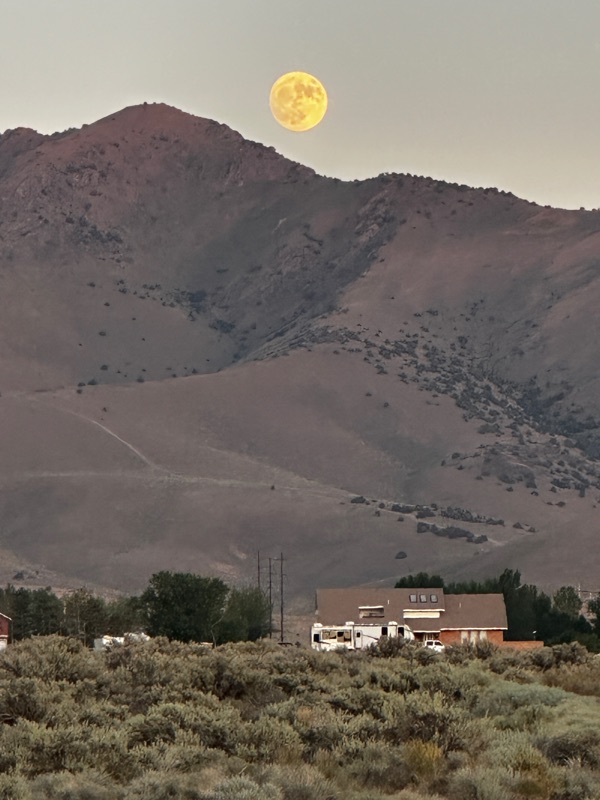
We're on the Road Trip of a Lifetime! We just spent a month driving through Idaho and Washington, Alberta, British Columbia, and the Yukon Territory to get here, and we're loving this adventure! Having just crossed the border from Canada into Alaska at Poker Creek (the most northern border crossing in the US), we continue westward on the Top of the World Highway toward Chicken, AK. If you'd like to see details of Chapter 1: Getting There, it's available from the pull-down list on the right of the screen.
6/9/22 This route has absolutely spectacular views. We were glad for the extra hours of daylight of our northern latitude here. The Top of the World Highway from Dawson City, Yukon Territory was a dirt road, albeit a well-maintained dirt road, but once we crossed the border into Alaska, the road became paved. Yay!
But that didn't last long. The dirt road now wasn't in as good shape as its Canadian counterpart. But the views kept coming.
We pulled in to the town of Chicken at dinnertime, and discovered that the town was hosting a country music festival this weekend, "Chickenstock". So, their one campground and the whole town actually was overflowing with tents and rv's. We ducked into a cafe bar to see where the next chance for camping and dinner would be. The bartender said there was a campground about 20 miles further up the road, and he could see if the cafe had any chicken pot pies left from their lunch special. Very nice!
This place was so eclectic! The cafe and bar were small, and all the walls were lined with baseball caps.
Adjacent to the bar was a little souvenir shop. Not one wall or floorboard was plumb or flat; the building had a definite downhill roll to it. I get the feeling that this is what Interior Alaska is like; businesses that run only after the snow melts, and the buildings are used in whatever shape the winter left them in. Eclectic is the name of the game. With just enough whimsy to make you chuckle.
We gratefully took our chicken pot pie to-go, and headed down the road to camp. The road was paved from Chicken Onward, although it had more bumps and potholes than the dirt road.
We pulled into the West Fork Campground, a state-run park, and it was so nice! And, wouldn't you know it, we saw a familiar Casita trailer as we were picking out our spot. Sure enough, it's Mark and Elizabeth! They decided not to head all the way to Tok, and like us, there was no room at the inn in Chicken. So we chatted away for an hour about everything we had done since we last saw each other (just 24 hours ago, lol!), and where we were all heading next. And, although our list of places is similar, our timing from here on will be different, so it's unlikely that we'll run into each other again on this trip. But, I still had that feeling that fate would prevail, and we'd be crossing paths again.
6/10/22 Heading out this morning, we are traveling toward Fairbanks, and will probably stop around Delta Junction, but we'll see where today takes us. First stop is Tok, to replenish our grocery supply, and to wash Lexy. After hundreds of miles of dirt and gravel roads, Lexy was covered in mud.
Trying to wash a van covered in mud in a record 6 minutes flat was a challenge, but we got most of the mud off before the wash service timed out.
We continue on the Alaska Highway past the eastern edge of the Alaska Range, giving us just a little sampling of what our future stay in Denali National Park will be like.
Then, onward to Delta Junction. This is the current official endpoint of the Alaska Highway. And nicely enough, they had a number of signs with this information posted at the junction of Route 2 and 4, as 2 turns north toward Fairbanks. This is a perfect spot to put a visitor center.
And a whimsical warning of what's to come.
Oh no! Phil falls prey to the monsters.
We pick a campsite at the Delta Junction campground, have dinner, and then go out for an ice cream at the coolest ice cream and locally-grown fancy meats drive-in we've ever seen. Only in Alaska.
6/11/22 We head up Route 2 to Fairbanks. Wow! Cityscape!
Out at the fairgrounds there was a Farmer's Market. Sweet! Additional to local foods and produce, there was a marimba club perfoming, giving the affair a calypso vibe.
Right next to the farmer's market adjacent to the fairground was a campground, and yay! They had a spot for us. Very convenient, close to town and yet in a cluster of trees for the woodsy effect! We checked in, got in our city clothes and went out on the town to celebrate my birthday. We picked a Moldovan restaurant "Soba", just because we'd never been to one before, and because most of the other restaurants that were open on a Sunday were Thai, and we just thought that we have great Thai restaurants at home, so do somthing different in Alaska. We were so glad we did! The food was fabulous.
We used to have a Moldovan au-pair when our kids were little, and we wondered why she put sour cream on everything, even her breakfast cereal. Here we are, at a Moldovan restaurant and everything we ordered came with a dollup of sour cream on the side! Stuffed cabbage leaves, cheese and garlic-stuffed pastries, oh my, the feast we had!
6/12/22 Smoke had moved in overnight from fires west of us, and the Fairbanks area was inundated. No hiking today, with an AQI reading of 265. Looking for lower-energy things to do, we checked out Pioneer Park, which was built in 1967 to celebrate the 1967 Centennial Celebration of the Alaska Purchase.
The park was located along the Chena River, which also had a very nice walkway for some distance through downtown Fairbanks. Lots of historic buildings and little museums are in the park; it's a fun place to hang out.
We had wanted to go to the famous Salmon Bake restaurant in the park, but it was booked for a private party. Some other time!
Most of the buildings were transported to the park from other locations around Fairbanks. But it was fun to walk down what felt like a historic Main Street.
The smoke was really getting thick, so we looked for indoor things to do. So, we visited the University of Alaska Art Museum.
This was a highlight of our time in Fairbanks, I loved this museum! I was especially fascinated with the local Athabascan and Tlingit pieces.
Then, the whimsy of Alaska was also represented in a number of pieces throughout the exhibits.
Here is one that makes me wish we had an out-house to decorate.
When we stepped outside, we were going to walk through the botannical gardens, but it was just too smoky.
I hope this jogger doesn't have far to go!
Smoke is predicted for another two days, so it's time to get out of the Fairbanks basin for a bit! Onward to Chena Hot Springs!
6/13/22 The road to Chena Hot Springs was due east of Fairbanks. A beautiful drive, where we felt like we were always about to approach a castle, with the straight-as-an-arrow roadway lined with tall trees leading us up a grand drive. The smoke abated to nearly nil, so we could breathe easier again!
Chena Hot Springs Resort is a quaint village with that Alaskan roughness and charm.
They have lots of lodging for guests, an ice museum with two resident sculptors, as well as an indoor pool, multiple hot tubs, and the specialty of the house, an outdoor natural pool fed by the spring.
They also had a small campground, so we found an empty spot and became residents for a day. And, what on earth? They had a real airplane mounted on display, hovering over the cook's greenhouses. Whimsy,, I tell you!
The soak in the pool was absolutely divine. You could move around until you found just the right temperature. Ahhh! And, I think we figured out that the slight smells of minerals in the air (not strong enough to be bothersome) kept the mosquitos away while you were in the pool. But, you were fair game to the spring hatch population when you got 50 feet away from the pool! The mosquitos were pretty thick in the air here. Fortunately, our newly installed screen doors on the van were holding up nicely. From our campspot, we could watch as people left the pool house, and about 10 yards away, would start swatting. I shouldn't laugh because we had our turn fighting them off too, but there were these three young men, most likely military personnel from Fairbanks (you could tell by the haircuts and the matching shorts) who left the pool house without their shirts on, all walking in stride. As soon as they hit that 10-yard distance from the pool house, they all started swatting the air and slapping their shoulders and legs, and kicking their feet to shake them off, all while trying to walk faster to their vehicle for cover. I just had to chuckle at the sight of the three of them.
6/14/22 In the morning, we decided to chance the conditions and take a walk. With the smoke in Fairbanks, we hadn't been outside, and we really needed to stretch our legs on a good walk. We used a non-deet bug spray and even brought it with us, just in case we needed an extra dose. We started out walking into the wind, so the bugs weren't too bad. But, if we paused for just 10 seconds, they all caught up with us.
We then noticed that there was a swarm of mosquitos forming behind us, and floating along with us. We started thinking, what will happen when we turn around? Well, about a mile out, the bugs started getting thicker and quicker, so we decided to head back. Yikes! As soon as we turned around, that swarm that was following us was upon us. So we walked faster. But the wind was now with us, so they just rode the wind and stayed up with us. So, we walked faster than the wind. Literally! Even ran like the wind! I was trying to apply more bug juice while keeping a swift pace, and they were just swimming in the oil on my skin, laughing at my folly, and biting me all along. Let's just say, this was my fastest mile I trotted in probably 20 years. I guess I wanted some exercise, but really, I did not need the adrenaline to go with it!
Safely inside our camper, we decided to head uphill a bit, maybe on a ridge to get some reprieve from the bugs. So, we headed back to Fairbanks. It was still smoky, so we went to the Ice Museum downtown. Very cute! There is an annual ice sculpture exhibit every March at the faigrounds in Fairbanks. It's a big deal here. To give it honorable mention for the rest of the year, the Ice Museum shows a movie highlighting some of the art pieces in this theater downtown, and then it also has an exhibit that you can walk through right in the theater. Very fun!
There were pieces that we could sit on for photos...(Santa's sleigh)....
and even a bar. Quite cool! Literally!
We still had hours of daylight after the ice sculpture display, so we thought we'd try heading north, out to Chataneka RIver on the Steese highway. On the way, there was a pull-out where you could get up close and personal with the Alaska Pipeline.
The pipeline runs 800 miles, from the oil fields in Prudhoe Bay up north, to the shipping port in Valdez, on the southern coast of Alaska. We have intercepted it here, just about 100 miles south of the Dalton Highway, where the pipeline parallels the highway due north to Prudhoe Bay. It is elevated most of its length, so that it does not negatively impact the permafrost, and this also allows animals to roam freely under it.
We found a campground right on the river. Not quite on a ridge though, so the bugs were still quite relentless.
They were so bad, I never even left the camper while we were here. Phil still diligently walked the site before turning in. A guy thing. It's really too bad too, because the campsite was so very nice otherwise!
6/15/22 The bugs were starting to get good at climbing into our van. We couldn't figure out how they were getting in though. Phil taped up the edges of all the window screens and the roof vent. I think they were riding in on our clothes, and then hiding once they got into the van. A carload of stowaways, great! Last night, I heard one or two buzzing around my ear, so I thought, each on might bite me once or twice, then they'd be done. So, go to sleep, it's just a bite or two. Well, in the morning, the place was full of mosquitos. I caught 38 actually, and all but three had blood in them, so between me and Phil, we were bit 30-60 times. I swore I would not sleep in the dark any longer, we're leaving the window covers off, so I can see them and kill them at night! It's starting to make me a little uptight!
Since the bugs were so bad, we thought we'd do some driving, and forget about hiking for a bit. Whether this takes us away from this crazy mosquito popuation or not, we could at least have some reprieve by having the car in motion. So, we head for the Alaskan Tundra, due north! Our adventure begins, we head for the Dalton Highway to reach the Arctic Circle.
This road was built for hauling supplies up to the Prudhoe Bay. The Alaska Pipeline follows it north, and it was only opened for the general public to use in the 1990's. It is and will remain a dirt road, as a paved road would not be sustainable in the tundra conditions.
This road has some insane hills on it! The truckers call some of the hills "roller coaster", and "beaver slide", to name a few.
One hill in particular was so steep! And, they had just put down a new layer of dirt, and had watered it. So, we were slipping and sloshing up the hill, just about to lose traction when we got to the top. Phew!
Along the way, we watched as the boreal forest transitioned to tundra.
We crossed this really long wood bridge across the Yukon River If it was strong enough to hold these big trucks, I guess we can cross safely too.
Just across the bridge was the hamlet "Yukon Crossing" A full-service travel station, with one gas pump, a cafe that serves burgers in the summer and ramen noodles in the winter, and a little gift shop. Across the pipeline was the Arctic Circle Visitors Center, where you can pick up a certificate for reaching the Arctic Circle (you are supposed to pick it up on the southbound return, but since we were there, the interpreter gave us ours on the way north, lol!).
We topped off our tank just to make sure we wouldn't run out.
And finally, after about 200 miles, we reached the Arctic Circle!
Way up there, at 66 degrees, 34 minutes Latitude.
Although we are just a few days early for the Summer Solstice, we did have bright light all night long. It is a phenomena that, although we know why it happens, it still takes some getting used to. Like, Terra Firma below my feet and Skys above my reach, these things are the constant in our lives. Now, with no night, it begs me to question all that is held constant in my little world. There are so many things that define true laws beyond what our personal experience and perceptions have given us. We put the big picture together with so many gaps between the pieces that are in front of us, and each of us has a different outcome of that final picture that we wove together. And when one piece presents itself between the others and the weaving around it doesn't make sense anymore, we're tasked with re-interpreting. Land of the Midnight Sun...an experience that will rattle and fascinate us for a long time.
Right at the Artic Circle was a brand new campground. It was spectacular, with great views and everything.
The bugs were fierce. I already ranted about mosquitos, so I'll just say, between being so excited to be at the Arctic Circle, the sun being bright all night, and the bugs, we didn't sleep well. But, we wouldn't trade that day for anything!
We met Doug and Gayle at the campground, and enjoyed an evening of giddy conversation. The Arctic Circle!!! Mind-blowing!
6/17/22 We left early the next morning to make tracks back down to Fairbanks, and then on to the little town of Nenana. The drive back went quicker than the way up, thank goodness! At Yukon Crossing, I saw this motorcyclist that looked so much like my Dad, I had to take his picture. I got to chat with him a bit in the cafe. He's from Chicago, and headed for Florida, and then decided to trek up to Prudhoe Bay, and then head down to Mexico. We'll call him a Continental Drifter.
Also at Yukon Crossing, there were many bicyclists coming south on the Dalton Highway. I chatted with one cyclist briefly; he said that it's a very popular trek, to fly bike and gear up north to Prudhoe Bay, and then to cycle down through Alaska, Canada, Mexico and even down all the way to the southern tip of South America. I.Am.Impressed.
Nenana is a tiny little town tucked under a bridge crossing. The main street seemed quiet and sleepy, with little houses and businesses, and a train station that was closed.
I didn't understand a train station being closed, but alas....
The grocery store had a huge mural on the front. It represented the town well, with multiple cultural overlays blended in this little town tucked under the bridge.
There also was a tiny Episcopal Church, St Mark's Mission.
The door was unlocked, so we went inside to say a few prayers.
The stained glass was beautiful. The space was reverant.
It reminded us of our little redwood chapel at St. Paul's in Walnut Creek.
We camped at the Nenana RV park, and enjoyed the luxury of electricity hookups and a really nice bath house, oh it was lovely! But, don't ask about the mosquitos, as I'm trying to block that aspect of this day out of my memory! And oh yes, they had a washer and dryer available to campers too. But, the dryer ran out of propane in the middle of our cycle, so we had to make due hanging the wet clothes in the camper while driving onward.
6/18/22 Next stop: Denali National Park! Of all our accommodations, this is the only reservation that we made before we left town. So, we didn't have to rush; we had a campspot saved for us. We enjoyed the emerging Alaska Range in the landscape!
We pulled into Healy and stopped at a small farmers' market. A couple was selling freeze-dried fruits, and we got chatting about what exactly is in the town of Healy. They mentioned that the true story "Into the Wild" had occurred not too far from town, and the bus replica that was used in filming the movie was parked at this bar across town. Other than that, Healy was a little place where people might stay if they wanted to visit Denali and pay less for their lodging (The park entrance was about ten miles south of Healy, and hotels are expensive there!). Phil had heard of this bar in town and the bus, and was hoping to seek it out. So, we drove up and down the two streets that made up Healy and did not see any bar or bus, but then just as we got on the main road to continue south, there it was. The Bus.
We pulled in to the 49th State Brewing Company (I wouldn't call this just "a bar"), where they served dozens of their brand name on tap.The bar was impressive, and so was their food menu.
They were setting up outside for an all-night Solstice Festival, with an outdoor stage and bands lined up to rock this little town.
And then, here is The Bus.
If you haven't seen the movie or read the book, it's a story about Christopher McCandless, a young man who shrugged off the college degree, money, and all aspects of modern civilization and headed into the forest in the northern edge of Denali National Park, to live off the land. He stumbled across this bus that had been abandoned by a lumber company years back, and lived in it until he met his fate months later. A heart-wrenching movie to watch, and once you've seen it, it sticks in a soft spot in your heart.
Inside, there are pictures and exerpts from Christopher's diary during his odyssey in the wilderness.
After experiencing this, we went in the bar and split a beer flight, to digest this experience. Oh my, the beer was good!!
A stop at the 49th State Brewing Company is a must for anyone heading to Denali from the north.
Continuing southward, it's time to get checked into the Riley Creek Campground in Denali National Park. The drive toward the park was gorgeous.
We pulled in to register and take a quick tour around the facilities, and wouldn't you know, we saw Doug and Gayle just pulling out! It was such a happy reunion, even though we had just met them only a day or so ago. But, that's the feeling you get after meeting a fellow traveler while trekking up the Dalton Highway to the Arctic Circle! We exchanged phone numbers so that we could share our routes and experiences for the rest of the trip. We are sharing with three couples now, and it brings joy to hear from them every few days!
Checking into our camp spot, we met Leonard and his family taking a walk. Phil struck up a conversation, and we got talking about spotting moose, and then that Leonard is a moose hunter and a chef, and he had extra moose summer sausage that he'd share with us. Whattttt!!!!? This was an incredible treat for us, because we learned that you can't buy moose meat, and you can't order anything made with moose in a restaurant, because selling any wild game meat is illegal. But, ever since Fort Nelson, when the docent at the little museum said that moose meat was the most delectible food on this planet, Phil has been wanting to try it. And here, Leonard offered us about a pound and a half of summer sausage that he hunted. We were grateful, to say the least.
We shared with him one of our California wines that we still had in our "wine storage" under the bench. Perfect, as he and his wife included the wine in their anniversary dinner that night. And, oh my, the moose summer sausage was absolutely delectible.
6/19/22 A bus tour into the park was on the agenda. But first, we celebrated Father's Day by going out to brunch at Rosie's Cafe in Healy. We were asking around for propane available, and a guy and his son, who were local, told us that Rosie's was the best breakfast food in the area. He said the place didn't look like much, but don't let that fool us. He was right. Rosie's looked like a long rectangular pre-fab building from the street, with a big billboard sign over it, saying, "Eat at Rosie's". We turned in, and were served by Rosie's grand-daughter, who was very proud to have made all the sauces, including a spectacular hollandaise on Phil's eggs benedict, and a blueberry jam served for my toast. Delightful!
Hopping on the Denali Park bus tour, we got settled into the last two seatsthat were together, but unfortunately they were over the wheel so I sat pretty-much folded in quarters for the ride. But, the scenery kept us totally engaged. We saw caribou! And Dall sheep. And rivers and tall peaks, and meadows. What beautiful landscapes!
it was great to get a narrated tour, but there was just a little disconnect, being in a crowded bus for 5 hours, and seeing the sights through the windows.
But we learned so much from our guide, so all in all we were glad we took the tour.
And, one thing we did not see was Denali, the highest peak in North America, capping at over 20,000 feet. We learned that it is common not to see the mountain from within the park, and as much as we tried, the clouds just didn't cooperate. But all these other peaks that are visible from the one road in the park were also pretty spectacular, even if they only reached 7000 feet!
Afterward, we decided to head back to Healy for another of their draft beers. It was so good!
6/20/22 - up for a morning hike to Horseshoe Lake.
Wildflowers were blooming everywhere. The vegetation was just so lush.
There were some very industrious beavers at work here.
And if we hurry back, we can catch the bus to the dog sled team kennels. The bus leaves from the visitor center. But, the hike back from the lake was up, up, UP!
6/21/22 After being on the bus all yesterday afternoon, it's now time for some serious hiking! We took the Savage River Alpine Trail in the park. Up early so we could get a parking spot at the trailhead. On the way, we saw a full rainbow..
You cannot doubt the splendor of God's creation when you are greeted with a rainbow at the start of your day.
This hike is just 4-1/2 miles, but its elevation change is 1500 feet, all in the first mile. Nothin' to it, but to DO it! And, no speed race here, just taking in the gorgeous scenery.
We passed a trail crew making new rock steps for a spot on the trail that had worn away.
Up Further we climbed.
And admired the flowers along the path.
Reaching the top of our hike, we would have seen Denali if the clouds had lifted. But, not today. Denali peak is over 60 miles southwest of where we were standing.
We could just stay up here forever.

The descent was a gradual slope, first through alpine shrub, then into forest, and we finally met the road and waited for a bus to come along and take us back the 4 miles to Savage River where our van was parked. Alas, the bus came, and just as we were getting into our Lexy, there was a bright flash, and a loud clap of thunder, and suddenly a downpour of showers hit us. We suddenly were concerned about the people that we passed on the way down, who were heading up in the opposite direction, and the trail crew working way up on the top of the peaks; were they ducking for cover from the lightening? We watched as lightening struck the ground on hills across the meadow. We then saw many of the hikers come down from the rock steps, rain gear donned, in quick steps from the trail we had ascended, looking for cover. All seemed in check, a little wet, but exhilerated by the exprience. I don't think that I would like to have to come down that steep stair-step path for a mile, feeling like lightening was chasing me!
All too soon, it's time to leave this beautiful park. We were headed south toward Talkeetna, and then to Anchorage. We were hoping along the way to finally get a peek at the ever-elusive Denali on our voyage southward. We'd heard that there were good viewing points along Route 3, so we aimed to stop and take our chances.
We stopped at Denali Viewpoint North, along the Park highway, route 3, and set in for the night. This was a strange campground, where it was all blacktop and arranged for rv's to line up as if waiting to get on a ferry. There were just a few other rv's there, and the other campers were very helpful in pointing us toward the mountain. But, alas, the clouds were still hiding the tall peak of Denali. But, they assured us that it would be unveiled come night time, as they had seen the peak the previous morning.
I was too anxious to wait until morning, so I peaked out at about 1am to see if the clouds had cleared yet. To my sleepy delight, I got my wish.

Silhouetted by the northerly-setting sun, Denali stood tall over the surrounding peaks. I had to just stare for a few minutes to take in the beauty and majesty of this peak. The name "Denali" translates to "Mighty Tall One" in Athabascan tongue, and this mighty tall one has been so named for thousands of years by all those who could see it, within a 300 mile radius. The name "Mt. McKinley" only came about because a gold prospector named William Dickey was fighting hard to help McKinley in the 1900 presidential election. Driven by McKinley's stance on maintaining the Gold Standard and the subsequent benefit to his prospecting activities, he wrote to the New York Times, introducing the mountain as "Mt. McKinley" in honor of this great candidate that will be as great as the tallest mountain in North America. After McKinley was elected and then assasinated in 1901, the name stuck in honor of the fallen president, regardless that he never stepped foot in the state of Alaska or had anything to do with the creation of the national park or any direct effect on the mountain or Alaska's inhabitants. In 1980 the national park was renamed back to Denali National Park, but the name of the mountain stayed "Mt. Mckinley" until 2015, when Secretery of the Interior, Sally Jewell was able to revert its name back to Denali as well. Most Alaskan inhabitants were thrilled with this, including native and immigrated white clans, as Denali is the name they had always known for their mighty tall one throughout history.
In the morning, we could see the white of snow and ice that permanently coated the slopes.
What a mighty one, the Tall One indeed!
6/22/22 We continued south on Route 3, and stopped in at Denali Viewpoint South, to catch another angle of this great peak. Still unveiled from its coud curtain, the mountain stood tall. The peaks in front of it are 30 miles closer, and all reach up in the 7000 and 8000 height. Imagine, Denali, 70 miles away, and still standing so high in the sky, as if it were truly part of the heavens.
I wanted to get closer, so I tried putting my phone's camera up to our binoculars.
I am awe-struck. Staring, unable to move or back away, we just took this in. There are times when you are overtaken with the undeniable presence of something so, so, SO much bigger than anything else in your life. Be it God, or the spirit of the Mighty Tall One, you are drawn to it, the always, all-knowing, eternal presence watching over you, looking through you, inviting you to become part of the greatness of the universe, just by letting go and listening to the silence. And, it will always be there, and you know where to look.
We watched as the clouds moved in and dressed the daily veil around the mountain. Though hidden, we now know it is always there.
We waited until the clouds closed in, just as a curtain closes on a splendid performance. Watching the final acts, I focused in on the frozen rivers, the glaciers in each crevace of the mountain range. Fascinating.
The day was moving along so with the promise to continue being in our viewing range, we climbed back into the van and headed further south. Our stop for today was Talkeetna, about halfway between Denali national park and Anchorage. We got a reservation at a small private rv park just two miles outside of town. Before settling in, we decided to check out downtown. A very quaint place right on the Talkeetna River, which was a streambed directly from the glacial flow. Glacial rivers have this interesting blue-gray color to them, from the silt that is carried along the way. And even from here, you could still see the very top of Denali, sticking up above the clouds in the left area of the sky.
Talkeetna is truly a cute place, and we were there in the middle of a heat wave. It was 86 degrees, unheard-of in these lands. Half the streets in town are gravel/dirt, and the weather was dry, so we worked to not kick up dust everywhere. Little curiosity shops and restaurants lined the streets; the ice cream stand was of course the most popular place today.
We had lunch at the Denali Brewing Company, and the shade and cool beer were a welcome blessing!
Lots of whimsy here. Alaska-style! Here are the floor paintings in the entrance.
The corner bar had that whimsy decor too.
And every little building we went into had that creeky wood floor and tilted door frame with a set of moose antlers positioned over it. So very Alaska.
One of the shops had some beautiful hand-made sets of drawers, and river tables. The crafted items were just gorgeous.
Heading now to our camping spot, the owner told us about a little park just 1/2 mile away where we could sit at the beach and cool off. That sounded splendid. So, we headed into the woods and found the lake, which was part of a cross-country ski trail in the winter time, maintained by the regional parks.
We went down to the water, and could not resist jumping in.
Then, we saw that we were not alone. A moose and her calf were dining on the weeds just around the corner from us.
We kept a respectful distance and tried not to act crazy or threatening, and all was good. Phew!
When we got back to our camp spot, we decided that we hadn't gotten enough of the mountains yet, so we scheduled a flightseeing tour with a company out of Talkeetna. First thing tomorrow morning. Yay!
6/23/22 Up early for our plane ride around Denali and the Alaska Range, we head into Talkeetna to the air strip. Here is our plane, an historic DeHavilland Beaver.
The pilot's name was Phil, and he invited Phil to sit up front. There was one other couple in the plane with us, who sat in the middle, and I got the entire back row to stretch out.
What a fantastic flight! Our pilot was well-versed in geology and other geogaphic features of the area. He described the features of a glacial valley versus a stream/erosion formed valley. This was the topography of a glacial valley, with lots of little lakes and divits in the land.
The glaciers look like 10-lane expressways through the mountains.
Fascinating seeing this all from the air.
And we loved getting a bird's eye view of the Mighty Tall One.
Phil described how glacial ice is formed under high pressure, which changes its reflective property to give off that beautiful aqua blue color. So, it really has nothing to do with the color of the sky. Water and ice under pressure are actually blue. Who knew!
Just spectacular.
And we were glad for relatively clear weather, so we had access to most of the Alaska Range. A flight we'll never forget. Thank you, Pilot Phil!
Spirits elevated from the flight, we now wander southward for Anchorage for a long-waited visit with Laura and Jerry. It's so good to see them! They are friends from Walnut Creek who are in Anchorage, remodeling their apartment from when they used to live in Alaska.
The sunsets are killer from their living room and deck (although you need to wait til midnight to see them!).
And look who moved into the nighborhood! Two eagles, in the cottonwood tree just 20 yards away from their balcony.
Unbelieveable! (Thanks Jerry for helping me hold the binoculars to the camera for this shot!).
Laura and Jerry put us up for nearly 5 days, for some needed R&R, repairs on the rv, and some hiking and sight-seeing around Anchorage. We are grateful!
Firstly, we get our windshield replaced. Two mornings after our Arctic Circle trek, we saw three 4-inch cracks coming from a dent just above the windshield wiper. Bummer; had we seen the hole earlier, we could have had it filled, but now, out with the whole windshield.
Then, dinner out on the town. We go to Humpy's for the absolute best halibut fish and chips in the world. Yummm!
Then, a tour of the town.
The Athabascan drying her fish, out by the harbor.
Anchorage's harbor is not very deep, and its tidal fuctuation is 30 feet, so its port is relatively small. A few cranes for hoisting, that's about it. Here we are at low tide.
A memorial park denoting the Turnagain Heights Slide during the 1964 earthquake. This side of Anchorage sunk down over 35 feet; all was destroyed by the quake and sea water backwash from the slide, and then subsequent tsunami waves an hour later, originating at the quake's epicenter just west of Anchorage.
The downtown statue of Captain James Cook, who had charted much of the Alaskan coastline in the mid 1700's.
Lake Hood (and Spenard), where there are more seaplanes than cars. It's fun to watch the planes land and take off. There are most likely more people in Alaska that are pilots per capita than any other geographic delineation.
6/24/22 While Phil took the van to get the tires rotated, Laura and I went on a walk around the neighborhood with the dogs. One thing that was hard not to notice was that the cottonwood trees everywhere were putting out their blooms, and there was snow-like fuzzy puffs floating around everywhere. It even gathered at the curbs like snow.
6/25/22 We visit the Anchorage Heritage and Cutural Center, and enjoy the displays of art and dance, with a dance and acrobatics team that kept a performance going the entire afternoon in the main lobby.
Earthen and pole traditional structures used before they were outlawed in the cultural "white-washing" efforts of the late 1800's - eary 1900's.
Haida demonstration of stretching hides. Everything had a spiritual connection, even the crossbeams in the ceilings were laid out to represent the sun, winds, and guidance of the spirits in daily life.
Tlingit totem inside a reconstructed community hut.
And, the gardens were beautiful.
After dinner, we head uphill for a nice evening walk overlooking the city, at the Glen Alps trailhead.
6/26/22 We trekked out to the south Anchorage shore at the Carr-Gottstein park, and walked out as far as we dared, being careful not to sink into the mud. The beaches are lined with very fine silt, a deposit commonly found in glacial terrains. You have to be careful not to get your feet stuck in the mud, as the tide comes in fast and believe it or not, people have been lost having gotten stuck in the mud with an incoming tide!
We picked up driftwood pieces, so Laura could design a driftwood wall hanging for the living room.
We all gave our best guess as to why these circles form in the mud. It was sort-of a science-based Liars' Club episode. And we still don't know why they form.
We returned to Glen Alps trailhead, and Phil and Jerry climbed up to Flat Top Mountain, a good 3000 foot climb. Laura and I stopped at a lovely viewing platform with the 2 dogs, and let the guys scamper up the skree to the summit.
Puppies were happy to trek around everywhere with us. But they were anxious to reclaim the back seat as theirs, and not to be banished to the back-back.
Back to town, we went for a well-earned pizza at Moose's Tooth. Delicious!
6/27/22 Back in the car and out to Thunder Bird Falls, and Eklutna Lake.
What a wonderful few days in Anchorage! We're so grateful to Laura and Jerry for hosting us, and visiting and showing us all around Anchorage, and Jerry even fixed our refrigerator. Jerry, it's still working great! You two are so great!
6/28/22 We bid good-byes, and headed south toward Seward and the Kenai Penninsula. Driving along the Turnagain Arms waterway, we took in the incredible scenery. First stop, Beluga Point, to watch the Beluga whales.
You can see them with binoculars, out in the whitish waters to the right.
Next stop, Bird Point.
Next, Virgin Creek Falls, between Girdwood and Alyeska Ski Resort, up Timberline Drive.
This seemed to be a favorite spot for wedding shots. We ran into a bride and her photographer while we were there.
I don't understand the new style of wearing a black dress and veil as a bride. Call me old-fashioned! But, the bride was beautiful.
We camped at Bertha Creek, and started to plan our time on the Kenai Penninsula.
We learned that Seward hosts a "marathon" foot race on July 4, where participants run about 4 miles total, up Mt. Marathon and back down, with a 3000 foot change in elevation. The town expects a crowd of 30,000 for this event. So, perhaps we will go to Seward first, and be far from there by the 4th.
6/29/22 Onward to Seward! The drive is gorgeous.
We stop on the way to visit Exit Glacier.
The trail up to the glacier was short, but buggy! But all worth it!
This glacier moves downhill at a rate of one foot per day!
The fireweed and other wildflowers were out early this year. Everywhere we went, there was a display of color along the road.
A few people were still cleaning their catch of the day at the docks.
There are lots of great murals here, and in fact, they are prolific everywhere we've been in Alaska. What an aesthetic treat!
We checked in to the rv site that followed the coastline for 2 miles! A bit crowded, but the view of Resurrection Inlet and the peaks across the inlet were spectacular.
We learned that this stretch of coastline had sunk over 30 feet into the bay in the '64 earthquake, taking most of the pre-'64 town of Seward with it. Seward was dessimated first by the sinking due to the earthquake, and then secondly by a 30-foot fire-surfing tsunami wave that came an hour afterward (there were oil tanks on the shore across from Seward that broke during the quake, spilling oil across the suface of the water, which then caught fire. Incredible tragedy). The rebuilding of Seward was then limited for permanent construction only on bedrock, which left a good strip of less stable land vacant. Perfect for RV sites!
After dinner, we walked the inlet shoreline. We saw sea otters, and also found the starting point of the famous Iditarod dog sled race.
6/30/22 We're up early, as we want to try to make a 8:30 glacier and sea tour, and we don't have tickets yet (we hope they have room). Yay! Got seats!
Wildlife spotted, right off the bat. An eagle greets us as we sail out of the harbor.
A sea otter is cruising in the inlet.
We saw a pod of humpback whales.
Then, two orcas crossed our path.
Up close with a tidal glacier.
Fascinating! It calved while we were watching.
Still early in the day, we pack up and head north, destined for Homer. You can see some of the scars from past fires on the Kenai Penninsula along the Sterling Highway, as we pass by.
Fires are not foreign to the Kenai Penninsula, but, like California, they have become a much higher threat in the last few years, with average rainfall totals dropping. A typical day here in June would have a temperature around 58 degrees with invariably a 70% chance of rain. While we are here, the average daytime temperature has been 72 degrees, and there has not been any rain for 40 days. Yep, things are changing. The fireweed blossoms have been blooming prolifically everywhere we have been in Alaska. As beautiful as it is, it has some of the local population on edge because they don't usually bloom until mid-August, and they are usually a sign that the first snow is not far off on the calendar. Fireweed also is the first seed to benefit the forest fires (hence their name, "fireweed") and germinates prolifically in their wake. We see them now blooming from a double-boost of early warm summers and lots of areas where fires burned last summer.
Even with an unusually high snowfall last winter (the lakes and rivers are all full and pushing their shorelines up their banks), the lack of rainfall during the long days of summer are drying out the vegetation. Things are changing.
We continue heading west on the Sterling Highway to Homer, and are taken at the absolute beauty of this highway! The weather feels like a beautiful day in Tiburon, moist and warm, and green! We stop at a visitor station on the road just shy of the town of Homer. It is so beautiful.
If there is a flower bulb in the ground, it is blooming right now on the Kenai Penninsula
The hills across the Cook Inlet frame this area as one of the most scenic coastal landscape that I have ever seen.
We make our way down to the "spit", which you can see in this picture above. It's that thin jetty of land that sticks out directly away from shore for a little over a mile. To the left (east) of the spit is Kachemak Bay, and right (west) the Cook Inlet continues northward to Anchorage. We drive to the end of the spit and find one campsite left at the Homer Spit RV Campground.
Like Seward, the RV campgrounds are lined up along the shore for high-density use, in areas that are unsuitable for building permanent structures. This works for us, because nearly every campspot has some view of the water and the peaks across the inlet. Along the spit, there are groups of buildings on pier-posts (I would beg to ask if they are considered permanent) that house little shops and restaurants, and charter fishing/sightseeing tours and freezing/cleaning services for the scores of sport fishermen that flock to Homer for halibut and salmon this time of year (it's referred to as "combat fishing", as it can get competitive with the high population of fisher-men and -women lining the shores this season).
We set up for the evening and indulge in showers at the bath house. The electicity, we find, is wired with reverse-polarity at our campsite, so we opt to "dry camp" here, to avoid blowing any electrical systems in our van.
7/1/22 Let's explore Homer Spit! We went to the Baliene Cafe for breakfast, which was fabulous. They even had delicious gluten-free rolls to substitute for the english muffins on my salmon Eggs Benedict, and the hollandaise sauce was to die for!
We walked further up the spit and took a detour out and off to the beach. Definitely a little more mushy than beach sands down south, but firm enough to walk on. Turning back toward the road, you see the piers holding up the building clusters along the spit.
The tide was low. Like in Anchorage, a tidal range is over 30 feet. Look how low the boats are, to the dock! Unloading a day's catch of fish is quite a hoist.
And in the private boat slips, it's a pretty steep hike up the ramp to the street level!
Walking along the road, you can enjoy the colorful architecture of the shoreline.
We stopped at the Sea Lion Gallery and enjoyed all the unique pieces they had on display. We were drawn to two prints that remind us of this trip; white birch trees and fireweed in bloom. Not too expensive, yay! Now, where do we store them safely in the van?
Back on land, we went to see the historic Homer, which was about two blocks long with old wooden houses, right inland from the public beach and park.
The beach was expansive. I have to wonder, with historic Homer right adjacent here, if there was a lot more buildings prior to the '64 earthquake. Most of the town is spread out and built up away from the water, with the exception of the spit.
We found a row of stone cairns built on the beach. So inviting, we built a few more.
Time to move on, so we set our target for Ninilchik, about 30 miles north of Homer, along the coast of the Cook Inlet. Hee-haw! There is a rodeo scheduled this weekend in town! We won't pass up the chance to attend a rodeo this time!
We find a really great spot, I mean REALLY great, and I would tell anyone planning to stay near Homer to check this place out, even if just for an hour. It's the Deep Creek State Recreation Area, a camping and day use area, situated right between the beach to the west, and a marsh just to the east. Talk about wildlife viewing!!! We saw a moose across the marsh, and at one point we counted 28 eagles soaring and sitting either on the beach or in the trees just to the south of the campground. Absolutely spectacular!
The campground was also directy across the Cook Inlet from two peaks, the Redoubt and Iliamna volcanoes. What a view!
Phil and I stood looking at the eagles for over an hour. We then were joined by another couple, Carl and Ginger, who had come back to this site to camp for a week because the wildlife viewing was so fantastic. They are full-time RVers, and have so much knowledge about traveling and specific details about just about anywhere in North America that you can think of visiting, they have info to share on it. They were amazing! We plan to stay in touch with them as we travel about.
Also camped out at this campground were two huge rv's with the name "Deer Meat for Dinner" emblazened on the sides of the vehicles, with pictures of a young family all dressed in camo holding rifles.
I guessed this was a youtube channel, and we stumbled on the video team. Yep, it turns out, this guy from Florida started his video channel, posting videos of hunting game and fishing, and he now has over 5 million followers. His channel had so much sponsor support that he was able to purchase the huge rv for his family, and another Class A 40-footer for his newly hired videographer. He and the family were camped here for the week, while he chartered a fishing boat for his videos. In the evening, the family was going up to Soldatna to fly out to Katmai Island to check out the bears feeding on salmon. I don't think he planned on hunting bears, but I'll check in and watch that episode, since we didn't get to Katmai on our trip. I was just talking with my sister Mary about this new lifestyle phenomena, where young couples and families are traveling and blogging, and they get sponsors so they can continue traveling and blogging, supporting their lifestyle. And then we park next to one of those families the same day. The nice thing about this family was they were still very nice people; stardom doesn't seem to have phased them, thank goodness.
7/2/22 We like this spot so much, we decide to lay over here for another day and watch the eagles. AND...it's Satuday, so it's RODEO Day!
We don't have to go far to join the festivities, as the Ninilchik fairground is just a mile down the road from our campspot. The festivities start with a horse race down on the beach at low tide.
All the local residents are here, and this is a hoot to attend!
Then, the party moves to the fairground, for the bull-riding and horse-riding acrobatics, and other fun events.
This was a local crowd, and it was a lot of fun. We loved it, and now I can honestly use the saying, "well, this isn't my first rodeo" and literally mean it.
We also went to check out the "old town Ninilchik", which like Homer, was a half-dozen very old houses near the beach, now occupied with interesting galleries and gifts, and some were private homes as well.
We went in one shop, and as expected, the floors tilted prominently to the west throughout the shop. The shopkeeper was a delight to talk with, and his collections of semi-precious and bead jewelry was made by local artists that he knew personally. It was a nice touch.
7/3/22 Time to move on, but we take in another few glimpses of these beautiful surroundings. Here is our View from the Loo. Imagine having this view first-thing in the morning!
And a volcano view across the inlet...
We head north toward Soldatna, and pass through the Kenai National Wildlife Refuge center,
and greet this moose just outside the building.
We then head into the town of Kenai. There isn't much of a downtown, but we found a beautiful little park up on a bluff overlooking the Cook Inlet.
Back on the road, we drove to the Russian River Falls on Carl and Ginger's recommendation. This is a 2.2 mile hike each way, perfect for stretching our legs. Just a little buggy, but we brought our DEET (Thank You Jolie for the repellant!). Unbelieveably, our biggest challenge was the heat! It was nearly 80 degrees. Being from Walnut Creek, you'd think we were used to much higher heat. We couldn't figure out why we were so hot with temperatures only in the 70's, until we heard this explanation: When you are at lower latitudes, the sun shines on your head at a higher angle, so you tend to shadow yourself. But, at higher latitudes, you get the sun full-on, with no shadowing of yourself. If you add up the square inches receiving direct sunlight, it's 100 times more with the lower sun's angle. Hmmm! I guess that makes sense. Anyway, it ws hot, and buggy. But well worth the walk!
We could see fish jumping occasionally. The water level was exceptionally high right now, so most of the fish were using the ladder on the far side of the river. But there were some jumpers! I couldn't quite catch them in the camera though.

Now, off to find a campsite. It's Friday of the July 4 weekend. There were no reservations to be had, so we took our chances with the local campgrounds. We went through a few and found no spots. Our goal was to camp near the Whittier turn-off, because we had ferry tickets from Whittier to Valdez tomorrow, so we wanted a short drive. We headed up to Bertha Creek campground where we were before Seward, and there were no spots. But, there was one very large spot and two bicyclists were camped in it, so the drive area was not occupied. We thought, "should we offer to pay for the spot if we could park in the drive area?" After evaluating that we didn't have too many options, Phil went back to talk with the bichcling couple. They said yes, we could join them! I did not expect that. We then proceeded to chat with them for a few hours, and what a delightful conversation! Our new friends were Dirk and Martina from Antwerp, Belgium. They were here on a six-week holiday, touring the Kenai Penninsula by bicyle, and were heading back to Anchorage on their last few days of their trip. It felt like we had so much to talk about; this was their first trip to the US, and people had told them they started with the best state, lol! They were just a few years younger than Phil and me. Maybe we should start riding more.
7/4/22 We exchanged contact info, and I snapped a shot in the morning as they prepared to head out.
Another friendship that I hope we foster going forward.
Onward to Whittier. The scenery is beautiful, of course.
To drive to Whittier, you have to pass through this tunnel through the mountains that is one-lane wide and has train tracks going down the middle of it. So, it has a schedule for east-bound cars and west-bound cars, and then east-bound trains and west-bound trains. They work through this cycle every hour.
And the, you emerge right in town. Whittier is a little seaport pressed against the mountains on the western banks of the Prince William Sound. If you approach it from the water, it is a quaint little town with a harbor and a pleasant boardwalk with little shops housing ice cream, fudge, and pizza vendors, plus souvenirs and excursion touring services.
There is even one fancy hotel and restaurant right on the water.
It looks a little different, though, from the road entry. The harbor is to the left, and the rest of the town is an industrial campus with warhouses lining the streets, and little hotels in 70's-style boxy buildings squeezed here and there between the warehouses. The streets are wide enough for a semi to turn around in and back up to the loading platforms on any of these warehouses. There doesn't appear to be any front to the buildings; everywhere you walk, you feel like you're in the back loading zone.
There is one huge apartment building toward the back of the town, pushed up against the hill with a huge glacial waterfall flowing right behind it. This is where everyone actually lives in Whittier.
It seems the town is still water-anxious, because all the buildings closer to the water were destroyed in the '64 quake, either from the quake itself, or from the 100-foot tsunami and the huge fire that followed. The apartment building was located as far away from the water as possible, without going up into the mountainside.
Now, it is the 4th of July, and the town is very proud of its 4th of July parade. Everyone is able to be in the parade, so many children have their registration signs affixed to their bicycles and ride in the parade.
Here are my favorite two entries.
After the parade, we walked along the boardwalk to pass some time before our ferry departure time. Phil practiced his kayackin skills using the THINK method.
Alas, our ferry boat arrives.
And we are off to Valdez!
Good-bye Whittier!
The Prince William Sound is stunningly gorgeous.
There are small iceburgs floating away from the glacial calving . There are islands to the right and left. A place of beauty, but a real challenge for large boats. Here is about where the Exxon Valdez rode into the rocks.
As we aproach the harbor of Valdez, we can see the oil facilities across the inlet, where the pipeline meets the tankers.
But, for the rest of our visit, I look only to the town of Valdez, where we have a long-awaited lay-over day or two. Yay!
7/5/22 We planned for a few days here in Valdez, yahoo! Time to catch up with ourselves and land for
a bit! We were staying at the Valdez RV
Park, right near the harbor. Before we
dive into our electronic minituia, we head into town and see some sights.
Down at the docks, there are some very interesting
statues. I can say, these are fantasy
beings; I have never seen a fish with an alligator head. Kids, am I right?
There is a short walk up to the top of this hill that sits
between the docs and the rest of town.
It begs us to take it, so up we go.
You can see the whole town below from up here.
We head for the museum, and take in Valdez’ story. I am so impressed that the native folks were
wearing waterproof clothing long before gortex was invented. These hooded jackets are made of bear gut
strips, with a strip of grass sewn in the seam to expand and keep the seams
waterproof.
More modern history in Valdez was defined by three events;
1) the Alaska gold rush, 2) the ’64 earthquake, and 3) the Alaska Pipeline
terminus at Valdez, and subsequently the Exxon Valdez oil catastrophe.
With the 1897 Alaska Gold Rush, the flood of mining
prospectors headed northward by land, which was an incredibly long journey to
get to interior Alaska or the Klondike area in the western Yukon
Territory. Valdez had a warm-water
inlet, and then just a few miles inland you could climb up the Valdez Glacier
up and over the mountains, thus taking a shortcut to the interior Alaska. It was still hundreds of miles, but that was
a better choice than the thousands of miles they would otherwise travel by
land. So, Valdez became a landing point
for gold prospectors, as they geared up for their trek up the glacier and
yonder to the land of Gold Dreams.
Valdez grew through the mining phase of history, and then
because of its warm-water port, a road was built to interior Alaska, and once
oil was discovered in Prudhoe Bay and the North Slope, it continued to thrive
as an oil transfer point, long after the gold rush dissipated. But, that was interrupted in March, 1964 with
the 9.2 earthquake. Most of Valdez was
built on the glacial alluvium right at the base of the Valdez glacier, which
provided no structure when the earth shook.
Half of the shoreline sank into the sound, and the buildings still on
land sunk into the mud due to the liquefaction of the glacial sands. For the most part, the entire town of Valdez
was destroyed. It was decided that
Valdez would be rebuilt in a new location, where bedrock provided a sure
foundation. The remains of the old town
were actually burned to the ground, and reparations began about a mile west of
the original town.
The rebuilding of Valdez was a success, and you will agree
if you step off the ferry, the docks are top-notch, and the boardwalk is a
lovely place to spend time, with public art and wooden benches lining the water’s
edge. The Alaskan pipeline emerges from
the hills at a point across the inlet, so the oil shipping activity occurs
across the way, separate from the town of Valdez. All seems to be in order until you hear about
the botched navigation of the Exxon Valdez tanker exiting the port with its
tanks full of oil, wavering out of the shipping channel and crashing into the
rocks in the middle of Prince William Sound.
The museum has a well-presented display of the clean-up efforts of that
event, although details of the accident are a little sketchy in the exhibit. We subsequently met the owner of a gift shop in
town, who was also a diver for the Coast Guard back when the accident happened,
and he had first-hand information on the accident. He felt that Exxon gathered too much of the
evidence, including his dive pictures and video, and that this evidence was
never seen again.
With a head-full of history, we wander around the block to
Brewery Lane, and visit the aforementioned gift shop owner, who has the most
elaborate collection of things for sale, and fantastic stories of how he
acquired a number of items that are on display and not for sale. We could have stayed in his shop all afternoon!
But, we meander next door to the Valdez Brewing Company to
check out their draught, and admire the mandala artwork on the walls.
The beer was fantastic, and the artwork inspiring.
As we walked back to the van parked near the docks, a man
drove up in his quad/cart, noticing our California plates. His family, believe it or not, was from
Paradise, and he wondered if we were familiar with the area. Yep, we are pretty darn familiar with
Paradise, with my folks, my brother, and my sister and family all recently
having left due to the Camp Fire, where they lost their houses. We chatted for nearly an hour about Paradise,
about Valdez, and past-present-future of both places. He had two Corkies with him that I got to pet
(miss you Porthos!), and he let me take his picture.

Then, we noticed a 4-wheel drive van parked next to ours,
with the name “@patoandlola” on the fender.
We were admiring some of the details of the van, with its slightly more
rugged structure than ours and more solar panels, and a man emerges from the
van and introduces himself. He and his
wife and twin 2-year-olds are from Cancun, Mexico, and have been on the road
for 12 months, traveling all over North America. They planned to be on the road
for one more year. I give them credit,
baby twins in a 22 ft van is commendable!
They had great stories to tell as well!
We now keep in touch on Facebook.
After dinner, we went for a stroll around the boar harbor,
and just took in the beauty of this place.
Valdez refers to itself as “the Alps of America”, and I do believe it
lives up to its name. We walked for
hours into the late evening sun.
7/6/22 Total Veg-out day!
Catching up on this blog, we never left the campground!
7/7/22 Time to mosey along.
We checked out the waterfall behind the Forest Service Information
Center at the start of the Richardson Highway.
Then, heading further up the Richardson Highway through the Worthington
Canyon, we see waterfalls and more waterfalls!
This is a gorgeous section of roadway!
We turn east toward Chitina, into the Wrangell-St. Elias
National Park, tempting ourselves to find a ride from Chitina to McCarthy, and
then up to the Kennecott mine. We did
not want to put our Lexy through any more dirt roads; we’ve been hard enough on
the van already and don’t want to press our luck. Along this road, Mt. Wrangell
presented itself in stunning glory.
We got out to the
Forest Service Visitor Station in Chitina and met Vickie, the ranger on duty. What a character! She was full of information and kept us
chuckling at her anecdotal descriptions.
We weren’t able to find a ride out to McCarthy, so we figured we’d save
that experience for next time we were up this way. We did camp along the Copper River just past
the bridge that heads out to McCarthy.
So, I guess we could say that we traveled a short distance on that
infamous McCarthy Road.
7/8/22 We head back to the Richardson Highway from Chitina,
and take a short detour off the highway to go through the town proper of Copper
Center. During the productive years of
the Kennecott mine, this was a bustling town.
We then stop at the Wrangell-St. Elias Visitor Center, just
north of Copper Center. This is an
impressive campus, with a theater, culture center, and physical geography
center as well as the welcome station and gift shop. They also had a lovely ½ mile walk that
started with a gorgeous view of Mt. Wrangell, Blackburne, and Drum.
Onward to find a campsite!
At Gakona, we take the Tok Cutoff Highway, and look for the road out to
Nebesna, following directions given to us by one of the local docents at the
culture center. We found it at Slana,
and head out, to find a nice campspot just about 7 miles down the road. What a beautiful spot, with a babbling stream
right next to us and all!
Our campspot was large enough to share, and soon a Dodge
Caravan minivan pulled in, and a young couple popped by to ask if they could
share the space with us for the night.
We said, of course! We then got
talking, and found that they had just travelled all the roads where we were just
heading toward, and vise-versa. So,
after dinner, overcoming mosquitos and all, we sat around the picnic table and
talked for hours about all the favorite places each of us should visit.
That evening, it started raining We went to sleep to the sound of raindrops on
the tin roof of the van all night long.
Pleasant Slumbers!
7/9/22 Rain on the rooftop! Blessed rain! We invited our newfound friends Tom and Lea over to have breakfast in our camper, and enjoyed a conversation about growing up in Liepsig as second generation citizens from former East Germany, after the reunification of Germany. Their perspective was intriguing and we again felt their insight made them seem wise beyond their years.
By 10am, the rain had subsided, and it was time to move along with the day. We were headed for Tok, they were headed for Valdez, and we bid our good-byes feeling richer for the sharing of our campspot and so much more.
We were off to Tok, and went to the Tesoro gas station, west of the intersection where the Tok cut-off meets the Richardson Highway. We heard last time we were in Tok that they allow you to use the high-pressure hose in the back for free to wash your car if you buy gas there. No quarters, no 6-minute timer this time. Poor Lexy needed a bath so badly, people didn't know that her original color was white. We also found a dump station and a separate potable water spigot back there, so we took care of everything in one stop. Score!
One more visit to the Visitor's Center to use their wifi for downloading and uploading our electronic minutia, and filing our ArriveCan forms for crossing the border on the 11th. Quick stop in the Three Bears for groceries, and we are all set for dry camping for a few days.
We then headed east on the Alaska Highway, toward a campground that Tom and Lea told us about, Deadman's Lake, which was beautiful, where they had a dock and canoes available to use, and the water was warm enough to swim in. It seemed unfortunate that it was called "Deadman's Lake", being that it was so beautiful.
There were two spots left in the small campground, so we were lucky. Walking around the park, we realized that we had found a real gem on the AlCan Highway.
We did have to fight mosquitos, but in the evening there was a nice breeze which kept them at bay. We meandered down a beautiful interpreter's boardwalk to a viewing post on the lakeshore.
We then went down to the dock, and found a 2 person canoe there, just waiting for us. In we go, and paddle out past the lilypads into the lake.
The sounds out there were diminished to where we could hear a dragonfly approaching, and the fish nipping at little bugs on the water's surface. So silent was the breeze
We would have stayed for hours, but we were pushing the sunset, and didn't want to pull into the shore in the dark. The sun is now setting at 11, as we move away from the solstice and work our way southward.
7/10/22 Lay-over day! Not a more spectacular spot to hang out for a day, after our canoe trip last evening through the lilypads. We slept in and made a brunch. Before we knew it, we heard the light patter o raindrops on the roof fan. With the mosquitos and now a light rain outside, and a bit of smoke from distant wildfires now moving into the area, we were content to stay inside our van for most of the day. We had thought we'd swim and canoe in the lake, but sometimes a day with absolutely no plans is good for the psyche. Sometimes, when in the van on the couch, it reminds me of a childhood dream of having a room like the inside of the bottle of "I dream of Jeanie", with Barbara Eden. Small, tidy, padded and curtained, it has a comforting cocoon aspect of which I do enjoy, at least for short periods of time. Too much time inside the van, and it starts feeling like we are living in a tin can. Thats not good. Time to break out and greet the world, bugs and all!
After dinner, a soft breeze picked up and cleared th bugs away, and we went for a short walk around the shore. We met a couple for Germany who were traveling for a year in their Volkswagen camper that they brought over. We then walked down to the dock and just stared at the water, shoreline grasses, lilypads, and fish biting at insects on the surface of the water. The silence was again magical.
7/11/22 Continuing along the Alaska Highway, we pulled into the Tetlin National Wildlife Refuge Visitors Center.
We were greeted by a docent intern named Kayla, and her coach Cora, a native and docent for 31 years, and was a tribe counselor before that. She had made many of the native clothing pieces, adding elaborate beadwork to the leather mittens and moccasins.
The center had a large deck, where we could see the refuge and the Wrangell-St. Elias peaks in the background.
We continued then along the Alaska Highway toward the Canadian border. The condition of this stretch of the road was horrible!
This was the part of the road that we would have come through on our way north, had we not gone up to the Top of the World Highway. All in all, the dirt road across the Top of the World was by far in better shape than this stretch of roadway! I do feel for everyone that thinks they are avoiding the perils of a challenging drive by avoiding the Top of the World and coming up this way!
We crossed the border, and I think our border patrol agent was the lost twin of Lady Gaga. She batted her eyes the same, her inflection in her questions had that same speaking voice, it was hard not to smile when she was doing such a great job at being very serious with us. But alas, after she instructed us on the new laws about declaring and forfiettng cannabis at the border, and since we did not have any with us, she rolled her eyes, handed back our passports, and turned away and said, “have a safe trip”. Kind-of like, “get out of my sight” with a New-York twang. We obliged, and drove off, now back into the foreign country of Canada.
Now on the Canadian side of the Alaska Highway, the road started to improve, and by the time we passed through Beaver City, it was as smooth as any well-maintained roadway would be expected. We could enjoy the scenery again, and not have our eyes affixed to the pavement! We again noticed all the fireweed blooming, just everywhere. It lined the roadway so beautifully, you would think that it was intentionally planted as part of a beautification effort.
You can also see fireweed just covering an area of a recent burn site.
At one point, an oncoming truck flashed his lights at us and stopped about 20 yards ahead. Yep, sure enough, they spotted a bear on the side of the road.. Wowed to a stop (screeching breaks scares them away, so we were careful). A grizzly! Our first!
He was busy eating flowers.
I was enjoying filming so much, I remembered to look at the bear, and not at my camera! How spectacular!
He then started looking at us, and I had that jolt, like I wasn't looking through the zoom lense right now, he was actually right there, that close!
Time to roll our car along before we annoy him! Thank you Mr. Bear, for this magical moment!
It had been raining most of the day, which with the bad road conditions makes tiresome driving, so we pulled into Lake Creek provincial campground for the night. The area hadn’t been mowed for a week or so, and of course the main weeds that were popping up everywhere were fireweed, even in our campsite.
Our travel journal continues in Chapter III: Getting Home
7/12/22 Continuing on the Alaska Highway, we stopped at Burwash Landing, to see the small museum there. I was endlessly impressed with this little museum. Their exhibits included taxidermy of real moose, musk-ox, sheep, every animal that you would run into in the woods around here, and they put them in such great settings, you felt like you were there with sheep on the rocks just above your head. Very impressive!
We continued along to Haines Junction, and for a few more minutes, pondered if we wanted to drive down to Haines, and then wait until we could get tickets on the ferry to Skagway. We already knew that we’d have to wait at least three days in Haines for ferry tickets. For that final decision, we chose to bypass Haines, and again save the Haines/Skagway loop for our next trip north. So, onward to Whitehorse.
Still pouring down rain, we could not find a campspot, so we joined our fellow travelers in the Walmart parking lot. It served us quite well!


No comments:
Post a Comment