
7/12/22. Continuing on the Alaska Highway in the Yukon Territory, we stopped at Burwash Landing, to see the small museum there.


 We also treated ourselves to dinner on the town. We head for The Miner's Daughter for a bison burger and halibut tacos.
 7/13/22 With the rain, we noticed that the mosquitos have dissipated! Maybe a lay-over day is in order. Anyplace where we can be outside the van without bugs, even if it's raining, is time to be cherished!
I was endlessly impressed with this little museum. Their exhibits included taxidermy of real moose, moskox, sheep, every animal that you would run into in the woods around here, and they put them in such great settings, you felt like you were there with sheep on the rocks just above your head. Very impressive!
We continued along to Haines Junction, and for a few more minutes, pondered if we wanted to drive down to Haines, and then wait until we could get tickets on the ferry to Skagway. We already knew that we'd have to wait at least three days in Haines for ferry tickets. For that final decision, we chose to bypass Haines, and again save the Haines/Skagway loop for our next trip north. So, onward to Whitehorse.
Still pouring down rain, we could not find a campspot, so we joined our fellow travelers in the Walmart parking lot in Whitehorse. It served us quite well!

Fabulous!!
Through the morning, we pick up groceries and supplies, and had our oil changed (they have jiffy-lube's up here!). At the Canadian Superfoods, the brands and packaging styles were just a little bit different than your standard Safeway, but it felt somehow similar to a distant memory for me. I finally recalled the connection; the grocery stores in Holland felt just like this (I was 12 when we lived in Holland for 6 months). This was a European market, here in Whitehorse. In the eastern provinces of Canada we knew to expect a more European feel but we hadn't observed this in the west as much. We then noticed that most of the customers in the store were speaking German. And, in the deli aisle, you wouldn't believe how many kinds of bratwurst they had available. Whitehorse must be a landing point for German adventurers. I guess it really is a landing point for all adventurers, as it does feel like a place to land and prep for your journey up to Dawson City and the Dempster Highway, or off to Alaska, this was a gateway to the North!
Now that we were here on our way south and our northern adventure is behind us, we wanted to see more of what Whitehorse was about.
We drove up to the Public Services building, where a large horse statue was built. It was a little hard to find, but with a little bit of poking around, we found it!


For lunch, we head across town to the Wood Street Noodle Shop.


7/13/22 Sleeping in, listening to the rain on the roof is marvelous, especially when you are warm and dry inside your cozy van. Alas, time to get up! We went to the Yukon Visitor's Center to use their wifi for a bunch of email communications on our to-do list.
I love this building. It is a must-stop if you're ever traveling up this way.

And then we went back to the Wood Street Noodle Shop for lunch again because it was so good yesterday. Lucas was there again, and the soup was warm and wonderful. Okay, time to make new tracks! We head east on the Alaska Highway for a few miles, and then turn south at route 37, the "Cassiar Highway".


Continuing down the Cassiar,


This drive along route 37A is, you guessed it, gorgeous. I think the entire province of BC is nothing but incredible vistas and scenery.


As we were there in the pull-out, a pick-up truck pulled in from up the hill. We asked if he had been up to the next viewing point nearly at the top of the mountain, and he said no, his wife complained that he was trying to do her in with fright, or with falling off the cliff, whichever came first. He said the road got narrower and steeper and rougher. That was enough for us to decide that we came as far as we dared with our camper van; this viewpoint will have to do!
On the way down, we saw a black bear crossing the river near one of the mining sites. That was cool! Our other wildlife fun was listening to all the new bird calls that we'd never heard before. One sounded just like a help whistle, and had me on guard thinking that somone was hanging off a cliff somewhere trying to get our attention. Another sang a musical pattern, each time in perfect pitch, to the note pattern of 4-2-1. I wasn't exactly sure what key they were singing in because it was a few octaves above my range, lol.
So, back down the road we went, into the town of Hyder.


7/15/22 We were so cozy here in Stewart that we opted for a lay-over day. It was drizzling, but there weren't any bugs! It was such a cute town. We headed to 5th St (the main drag) looking for a coffee shop. There was a diner in the King Edward Hotel, and one other Central American restaurant, but their coffee machine was broken. The other coffee shop/pizza place was closed. We went back to the hotel diner and ordered a big plate of poutine to split. Breakfast of champions! This town really needs a nice coffee shop! It also needs a jeep trail service to take people up the road to see the Salmon glacier! We contemplated the business plans for each of these, over poutine.
7/16/22 We headed out, back up route 37a to join 37-Cassiar south. Where to now? Prince Rupert sounds like a good destination. So we headed south, and then west again toward the coast on the Yellowhead Highway, route 16.
Just before we reached 16, we turned off at Gitanyow, which is a small village inhabited predominently by First Nation residents. We came into the center of town, and there were a few dozen totem poles standing in a field.


The Yellowhead Highway, route 16 was of course, gorgeous, as we moved westward, returning into the northern rain forest ecosystem.

We stayed at a campground in Port Edward, just south of Prince Rupert.
7/19/22 Driving around the inlet between Port Edward and Prince Rupert was other-worldly, it was so beautiful. Islands are scattered through the bay, and the terrain was just so very green.


I'm particularly drawn to the Tlingit boxes and woven baskets. The baskets are woven so tightly that they are waterproof.


We then visited the Sunken Gardens. Transformed from a bunker in WWII, the gardens are terraced down into this culvert, with beautiful plantings. The locals call it Buschardt-Mini.


7/20/22 Heading still eastward on the Yellowhead Highway, we pull into Old Hazelton.


There are lots of local residents hanging out on porches and business stoops, and you can hear the laughter of their banter, but the ambient sound behind that is nothing more than the soft sushing of the river flowing behind the buildings.


We stop for coffee at the one coffee shop in town that was open, the Mercedes Beans Model Tea. They made the best cappucino I've had in quite some time. Decaf-even! Their store decal mixed art style of modern and traditional indigenous art; it caught my attention.

I have always attributed this art style to the Tlingit people, but it seems to be shared among all indigenous groups in the Northern Pacific areas with minor modifications between geographic groups. Tlingit people always have the Eagle and Raven first and foremost, and then include the bear, frog, and other clans within the Tlingit nation. I am now versed enough to recognize Tlingit versus other groups, but I can't distinguish between the others. Maybe a few more months in these northern regions and l'll have this down.
So many of the small towns are populated predominently by indigenous groups, so you routinely see their clan artwork in murals and totems.
Then, we pulled through Smithers, a town settled by Norwegians. Not a "sleepy town" at all but bustling with shops and fanfare.


We looked over the BC map for an adventurous destination. How about Bella Coola? Way out toward the coast, and even better, it had a ferry service that would take us to Vancouver Island. Ahhhh! Much better, an adventurous destination to plan for. Our spirits were again renewed.
We checked the ferry schedule which ran only once per week, and it left from Bella Coola to Port Hardy in three days. 350 miles away, we can do that! So, we made the ferry reservation and left Prince George with spring in our step, heading off to Bella Coola.
We made it all the way to Williams Lake, through the pastoral countryside, and checked into the Stampede Rodeo Fairground campground for the night.

Time to hit the road. We have a ferry to catch in Bella Coola on Monday! Continuing westward on the Chilcotin Highway, we now consider this route one of the most beautiful that we've been on. Have I said that before? We do humor ourselves with this, how often we say, "this is the most beautiful.." and the next day we catch ourselves saying, "now this is the most beautiful....". All I can say is, if you travel in Canada and Alaska, you are going to see extremely beautiful landscape. And, you will chuckle at how many times you catch yourself saying, "this is the most beautiful road/mountain/pasture/forest I've ever seen."


They were standing in their own formation, head-to-tail, swishing their tails to keep the bugs off their own rump and their buddies' faces.

As we reached Tweedsmuir National Park boundary at Anahim Lake, the road turns to gravel/dirt. It continues for 50 miles. It is in pretty good shape, so no worries on our tires.

But, for the last 3 miles, it starts heading downhill. First, easy slopes, but then it advances to 10%, 12%, and even 15% slope warnings. Phil puts the van in first gear and we crawl down this big mountainside.


Thank goodness that he was content staying on the inside of the road, because if he opted to step into the street, there was no way to steer around him, the road was way too narrow. We crawled passed the bear, still in first gear, and all was copacetic.
Shortly after passing the bear, we reach the bottom of The Hill. Yes, after looking back at our maps, this incredible stretch of road is actually referred to as "The Hill". We talked with others afterward that had crossed it, and they said their brakes went out by the time they reached the bottom. What amazed me is there were travelers that brought trailers over this hill. I wonder if they'd do it ever again.
The road turns from gravel to chip seal at the bottom of The Hill, thank goodness. We pulled into Atnarko Campground, and there were lots of spots open. We camped right next to a babbling brook, but kept inside mostly because the bugs were fierce!


We decided to stretch out and get some exercise, so we found a trail to a waterfall. It was listed as "moderate" difficulty, so I was game. The path started as a boardwalk across swamp and muskeg.


What kind of fungus is this???
 Getting back to the van, we turned and looked up, and sure enough, we could see the falls we just hiked to. They didn't look very far away. Hmm. It sure felt like a long way to traverse to get there!

We rolled down the road into the town of Bella Coola, and checked out one more waterfall that wasn't quite so hard to get to.
Just drive past the hydro power plant at the end of the road, park and walk around the plant, and voila! These are called Clayton Falls.


So now, here we are in Bella Coola, arriving the night before our ferry trip. This little town perhaps has not been discovered by pop and posh travelers, or perhaps the COVID isolation impacted it, but it was just as humble a place as can be. Many of the walls of the larger structures had indiginous artwork, which picked it up a notch.

All the buildings in town were wooden structures whose roofs were ready for replacement and it seemed that a fresh coat of paint was an abstract thought that did not come to the minds of the homeowners here. The grocery store had odd hours and only took up half the original building. The harbormaster was using some of the extra space. Half the storefronts were vacant. Half the town was indiginous population, which typically would indicate a humbleness about the town center anyway, but it just seemed that there was a lack of energy here.

I chuckle at myself; when I find a little village that is over-ridden with posh and tourist attractions, I skoff at it. And, when I find a village that is just humble and quite happy going along on its own path, completely disinterested in whether I visit or not, or if I am impressed or not, I want to give the town a shot in the arm with a hopping coffee shop and bookstore or something. Jeez, Deb!
There is one inn and restaurant in town, where it's obvious that all the ferry travelers are gathered. We stop in for dinner and see lots of people there that we saw on our hike or at the campground and around town. Dinner was delicious.

Now for a campspot! We asked around, and there were no real campgrounds in the area. We had the choice of parking at the cemetery, or at the roller rink 10 miles east of town, or just parking on the street for the night. Phil checked in with the local police to see what options were legit, and they said yes, just park anywhere, as long as it's not in the indiginous neighborhoods, 'cause they don't like unknown guests. So, we parked on the street, right across from where we line up for the ferry onboarding. That was interesting, and we slept pretty lightly that night. But fortunately, we were up really early to line up for the ferry, so the night was pretty short. We actually were awoken at 5:30pm by early travelers lining up, and the harbor patrol were busy signing people in. Nicely enough, we only had to put on our clothes and roll the van into line at the grocery store parking lot (because the loading dock at the ferry is so little, they use the parking lot to get the cars all lined up, and then they shuffle the lines across town and onto the ferry).
And away we go!


7/25/22 We find that you cannot drive very much further north on Vancouver Island than Port Hardy, at least not without a 4wd truck, a winch and a chain saw. So, we are just going to check out Port Hardy today. It is not a huge town, so we are actually able to walk most everywhere we want to go.
First, we always start at the Visiters Center. Then, we walk around the dock in the very small harbor.


The boat's name was Pacific Grace. She was a beauty!


We headed back to our campspot and joined our neighbor Jeff in conversation. We offered a beer but he said he's cutting out everything that might shorten his life, and I will admit, his story was inspirational. Jeff lived in Williams Lake, where he owned a ranch with horses. He would make this trip annually to Port Hardy to meet up with his sister (in the next campsite over) for a week, where everyone would go out fishing for salmon. He was telling us about his catch, and pulled a whole salmon out of his freezer and gave it to us. WHAT!!!! How absolutely hospitable a thing to do!

7/27/22 Time to move along on Vancouver Island. We headed south and stopped at Port McNiel, which although it had fewer ferry traffic, presented itself more as I expected Port Hardy to be. There was a brewery, a dozen coffee shops and other restaurants, a larger harbor, and a lot of other polished and posh things to offer tourists.
The shoreline was a nice walk.


7/28/22
Time to had westward. The temperatures are rising even here on the east side of Vancouver Island, so our only recourse is to get on the west side of these hills and face the Pacific Ocean. From Campbell River, we take Route 19A south along the eastern shore just to get the flavor of these beachy towns on the island. Moving southward closer to the city of Vancouver, it's looking very fancy, with lots of inns and vacation activities, and lots of very nice fancy houses, oh my! This makes me think of La Jolla, and Nantuckett, the places that city people go to play. At Qualicom Beach we head inland on Route 4 to cross the island. We pull in for a stretch at Port Albernie. It still amazes me that there are these towns that are 50 miles from the ocean, but they have big ports because there is a fjord carved so far inland to give them deep water passages and harbors.

A stiff breeze is pouring up the fjord here into the harbor. It's 95 degrees everywhere else, but the breeze feels more like about 80.


We climb this lookout tower and enjoy the breeze even more.


It's about 6:30pm and we finally roll out to the end of Route 4 and meet blessed fog, to the junction on the west coast where Ucluelet lies to the south and Tofino lies to the north. The Pacific Rim National Park is to the north, and we are pretty sure that there will not be any spots available. After talking with a few people, we discover that this is the "big weekend", the first week of August. We asked what holiday it was, but the only way people refer to it is the "long weekend". We had taken a few virtual snapshots on the road as possible boondock spots, but we were talking with Tom, an Australian RV traveler that we met at the visitor center, who told us that he had been boondocking in the area, and he had things stolen by some of the indigenous folks that live here, so batten down everything so nothing can be taken. Hmmm. We decide to take our chances that a spot might be available at the park campground.
And, miracles of miracles! There was one spot that gets saved for "emergency use", that the park lets go after 7pm. Sometimes, timing is everything. We're in!

7/29/22 In the morning, we check in with Ted and Liane to see what their plans are for the next day. We both told each other that, if we are able to get a campsite, we can share it with our two vehicles. We then headed north to Tofino, and they to Ucluelet for the day. But first, a quick walk on the beach. It's foggy and ethereal.

We come across a spectacular sand castle, still intact from the tide.


Now, a 10-mile drive north to Tofino!

Tofino is a wonderful beach town, set in this exquisite topographical landscape. Surrounded by water and islands and fog and sunlight, the hills and water inlets shine as precious gems on the horizon.


There are inns, cafe's, art galleries, surf shops, kayacking lessons and restaurants lining the streets and shoreline, between which local inhabitants keep tidy their wooden bungalows and churches and grocery stores.
We stop at a coffee shop that has a back balcony that looks over the inlet to the north. This is magical; we end up staying on that balcony for over an hour, just gazing out.


We met up with Ted and Liane after dinner and walked down to the beach together to catch the sunset.

These huge trees, root balls and all were strewn around the beach. The force of water....


7/30/22 We drive down to Ucluelet, and are so impressed with great access to public parks and walkways and beaches. We take a walk on the Lighthouse Loop path at the very southern edge of the Ucluelet peninsula.


7/31/22 The traffic in the morning was nil, thank goodness. We had the obstacle of that construction site, but we timed it perfectly because just as we were arriving, they were piloting our lane through.


First Stop: Uphill to the Cypress Lookout to get a good lay of the land.


The Vancouver Museum, near Granville Island.


We went back across to West Vancouver for dinner at a hot-pot restaurant. It was blazing hot outside, but somehow this felt like a good choice for the day.
We stayed out in Burnaby for our first night in town because it was still the holiday weekend, so there were no rv parks closer to the city that had vacancies.
8/2/22 Back into the city, we checked into the Metropolitan Hotel. Woohoo, what a nice place. On the 12th floor, with a lovely view.

Back to the fun of being in the city. For our anniversary, we had a long lingering meal at the hotel restaurant. We shared everything we ordered, which were, for the most part, all on the Appetizer's page of the menu. Splendid and tasty!
Charcuterie to start....


Next day, we head out to Chinatown for Dim Sum at the Jade Dynasty restaurant.


Vancouver is such a bright and fun city!
We also went into the Vancouver Art Gallery, which was not quite as big as I had expected, and I rather found the city of Vancouver more aesthetically attractive than the museum exhibits, strangely enough because I love art museums. Well, on with the beauty then!
We visited the Christchurch Episcopal Cathedral, a building of reverent beauty.


Then, we had to go back and visit the Granville Island shops and public market, just one more time.


Phil's tostada was exceptional, and that color was out of this world.
 Alas, time to roll along. We bid Vancouer good-bye, and headed south for the border.
We entered through the 99/5 entry at Blaine (it took an hour; not good timing on our part) through the "Peace Arch".


We talked with our host and she let us stay an extra day out in the field. Seemed about as isolated as we could get, out here in the cow field, so we indulged in staying put for a day to regroup and replan the rest of our trip. Our visit with my sister Mary and family near Seattle was out; also our friends in Oregon. Should we dart home through a heat wave down I-5, or take a slower and cooler route along the coast? Either way, we were still 1000 miles away from home, at least three days out. Thank goodness, Phil did not catch it! I was feeling quite a bit under the weather, as the doctor described, with "moderate flu symptoms".
We opted to take the cooler route home, as Portland and central Oregon was reporting temperatures above 100 degrees. So, we bolted for the coastline, with Aberdeen WA our first destination.
Little known fact: Kurt Cobain, leader or the rock group Nirvana grew up in Aberdeen. With lots of followers dismayed with his untimely death, a memorial park was formed in his honor, near the bridge where he used to practice guitar. Here we were, so we stopped in to see the site.


From here south, we just drove and checked for availability as campground signs came up on the roads. I wasn't feeling that great, so I broke a law and rode lying on the bed in the back of the van while Phil drove. This was my view for most of the day.


We camped at Nehalem Bay, just south of Manzanita. I love this area, and was bummed to have to breeze through without even stepping out of the van. Next stop was Boice Cope campground on Floras Lake. I think we should reserve a spot here for a week, this was such a cool campground! Floras Lake is right on the pacific coast, so you have both the lake and the ocean to enjoy. And it was not a crowded spot, it was like you really needed to know it existed to find it. Beautiful.


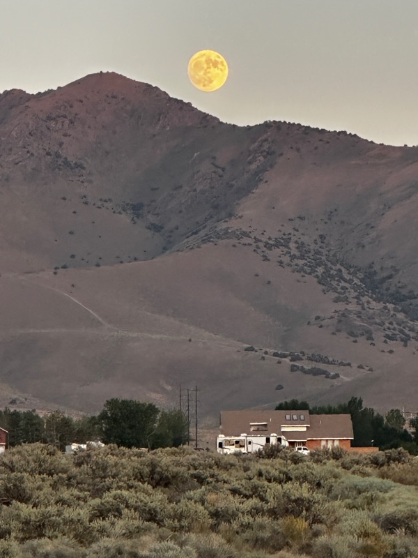
And, what a lovely sunset.

8/11/22. Continuing southward, through Gold Beach, and giving nary a drive-by shout-out to Mark and Jennifer in Brookings, we crossed the border into California and felt welcomed home. Nearly home, that is! Still 350 miles to go!

We look forward to when we can spend more time here in Crescent City.


And, alas, here we are! A sight for sore eyes.


What a fantastic Road trip. We are changed forever by these experiences and touched by all the people we met along the way.


No comments:
Post a Comment