It's been since last May that we've hit the road! Phil and I have found that we're not big on traveling in the summer months. We like to leave space on the road and in the parks for everyone else that has to travel in the summer, since we can hit the road any time of year. So, staying at home for the summer, and over the Christmas holiday has become our pattern, and any other time, away we go. So, here we are, getting back into the swing of things. We've been fighting that urge to "get out of Dodge" for the last few weeks, so this trip can't come soon enough!

Packing is easier because it's so familiar, but it still seems to take too long. Thank goodness for our extensive packing list. We're at that point where it's easy to forget the details, so we stick with a tried-and-true list. As I type, I notice my thoughts sounding more and more like my Mom, and I look down and see her hands typing away at the keyboard. I can hear her voice saying, "Make a list!", "Stick to the list!" Oh my, does that happen to anyone else?
So, after two days of packing, wrapping up home projects and setting other activities to run in our absence, we finally shove off and head south. It's delightful to see California in all its green glory, I love traveling in California this time of year. Even as we drive down I-5 through the Central Valley, the hills are green and the fields across the valley are freshly plowed. Then turning southeast on Route 58, we head along the northern edge of the Transverse Range through Bakersfield, zipping around and through the land of rugged hills and lonely cows. All feels as it should be.
We had just gotten a new battery for Lexy's engine, and then decided to replace the coach batteries as well, since they were five years old and not holding much of a charge. We were humming along, with this feeling that our supply tanks were full, our batteries were charged, and this was going to be a cakewalk of a trip with clear skies predicted for the first three weeks at least, of a monthlong trip. While taking in all the greenery in the hills, I happen to look at our coach battery monitor, and I noticed that it had a 60w drain on it and the charge was down to 82%. How could that be? We have 300w of solar on the roof, I have to imagine that at noon, we were getting at least 150w, plus the engine is running. That new battery should be swimming in amperage coming into it. We were running the fridge on battery, but again with the solar and the engine running, the drain from that should have easily been compensated. Aghast with sudden disappointment, we have our first challenge of the trip. On Day One, no less. My head is grinding through all the other electric scenarios we've been through, hoping to connect these new conditions to something we've learned in the past. We're spending the night at the Elks Lodge in Hesperia near Victorville, and they said they have electric hookups, so we can test to see if the battery takes any charge from the shore power while we're there.
Well, here we are parked at the Elks Lodge, hooked up to the electric outlet, and the shore power and converter are working fine. So, somewhere along the engine power separator solenoid to the coach battery, there must be a fuse or breaker that needs attention. The solenoid is reading voltage just fine, so we'll figure this out, maybe with a little help from kind strangers and Pleasure-way online groups. Hmmm. No fridge power while we drive, unless we are okay with either running down the battery, or driving with the propane line on. Not a good plan. Go with the former.

Our first stop on this journey is to visit Sean in the San Bernardino Mountains. Long-time friend, and haven't seen Sean in-person for years! He and Jane recently acquired a lovely vacation mountain home (we can't call it a "cabin" alas, because it is a three-bedroom house with very nice appointments of granite and other luxurious surfaces). Jane stayed home in San Diego, caring for their beloved Great Dane/Shepherd mix (Hello Jane! Sorry we missed you!).

Sean is an engineer and a car mechanic's guru. When we told him about our evasive fuse on the battery line, he jumped in to assist. Checking on the power line from the isolator solenoid down under the car, he confirmed that there was no inline fuse on that line. Opening the fuse and wiring panel under one of the seat ottomans inside the van, alas there it was! A breaker was thrown on one of the battery lines. Phil then remembered when the batteries were installed, the "flunky" that was installing them did arc the charge once, and shrugged it off like there wasn't anything to worry about. Sean reset the switch, and we fired up the engine and watched the battery monitor with intent. And, there it was, voltage rising to 14.5, and amperage on the rise, even with the fridge on battery power. Yay!!!
SEAN, YOU ARE OUR HERO!!!
Still, we watched the power monitor closely for the next few days of driving, just to make sure the breaker wasn't thrown again. What a wonderful, albeit short visit, where Sean treated us to a delicious dinner, and fixed our Lexy. We are whole again, and pampered, and ready for our adventure ahead.
Onward to Ramona! Phil's brother Rath and hubby James' place is a favorite place for us to land. Whenever we are south of LA, our van nearly steers to their house automatically.
Driving around this part of the state, I do feel a lifting of spirit. Be it the cool desert air or sunshine, or the abrupt hills and boulders strewn across the topography, I don't know. But, it feels good, timeless, liberating.


Arriving at Rath and James' is like coming home in many ways. On the table for discussion is our past, present, and future. Lofty or down-to-earth, the topics we dive into are endless and without bounds.
I love their place!

They had just enhanced the deck furniture with new umbrellas. What a delightful place to hang and visit.


We keep forgetting to get a picture of all of us; James and I are really there, just behind the camera.
Alas, another short overnight visit, and we tear ourselves away to continue our journey.
We head north on route 78, and then continue through the hills on route 79, passing through that beautiful high-desert countryside, with family farms specializing in avocados and nuts, and herding goats, and we even saw a camel dairy.
We took a detour at Anza to ride a memory of Phil’s, up Terwilligher Road toward the hills. Years and years ago, Phil and his friend Todd had taken a life-changing backpacking trip in these hills. They were sixteen. I thought it was amazing that their parents dropped them off, with instructions to pick them up a week later. Maybe they were comforted into it, thinking that it was a Boy Scout trip? Gladly, Phil and Todd lived to tell about it, and that’s what counts.
Once we pass Anza, we turn on route 371, and the flora becomes particularly sparse; we’ve definitely entered a desert environment. And, the road was narrow and winding, with lots of very steep drop-offs. What a rush!


We are heading for Palm Springs, where we get to visit with Jolie and Scott. As we passed the last ridge, the road straightens out and heads straight down for miles, leaving us feeling like we are in an airplane descending into the vast Coachella Valley on this runway of a highway. Weeeuw!


Jolie and Scott spend their winters down in Palm Springs, in a fancy RV park where everyone knows each other, there is a cocktail party going on most every night at the clubhouse, and everyone has their favorite sport they practice all winter long.Although our friends aren’t into the cocktail parties, the tennis courts beckon them with a passion. We indulge in the premise of snowbirding while visiting them in this warm winter paradise.
Our first night in the valley is in Desert Hot Springs, at the Mineral Springs Date Farm, across the highway from Palm Springs. This is a Harvest Host site, and the menu we pick from in exchange for our stay there was a pound of dates, a pound of date spread, or a hot dinner of Kimchi ramen. What an unusual combination of items to choose from! Since we hadn’t eaten dinner yet, we met up with our host, Ron and got settled, then we met Anyu who offered us the kimchi ramen. We also bought two pounds of dates. The ramen was absolutely exquisite. As it turns out, Anyu had been a prominent chef in the Korean restaurant circuit. How her family ended up buying a date farm and settling in this place is a mystery to us!

Now we get to spend the day with Jolie and Scott, so we head downtown together for coffee, and walk around taking in the sights. This being Black History Month, there was a parade downtown celebrating and supporting the culture. We took in other cool sights, and then drove around, checking out some of the examples of mid-century modern architecture in the area. I loved this! And, a late lunch at a vegan restaurant; I had the best “chorizo” tacos ever! What an absolutely fun, leisurely day, meandering through town, hanging with our friends.


Our accommodations for the night were at St. Clare’s of Assisi Catholic Church, another harvest Host site, down near La Quinta. Jolie came down and met us for breakfast at Cups Café the next morning, where we ordered delicious Huevos Rancheros. Then we were off again to our next destination, now heading for Joshua Tree National Park.
Having visited this park twice before, we were perplexed at the lack of ”there” there. So many people we know tell us it’s such a beautiful park. Our son Adam happened to call us on the drive, so we asked him, what is so special about Joshua Tree National Park. He said, “Oh my gosh, well for one thing, it’s the only area where the Joshua Tree grows in the world. Then, it’s a Mecca for rock climbers to boulder-hop and climb boulder-rocks. And, it’s so beautiful. But, you do have to turn off the main north-south road through the park to see everything.” A-ha! Maybe that’s why we felt the park was so lackluster. The two previous times we were here, we had just enough time to drive from the south entrance up to the north entrance. We didn’t even camp in the park because we hadn’t made reservations and the park was full. So, we ended up boondocking in BLM land just south of the park and then drove straight through. This time, we are spending two nights in the park, so we have time to drive all the roads in the park, and take in all those spectacular sights that everyone talks about.


Joshua Tree National Park straddles a ridge that separates the Colorado Desert in the south from the Mojave desert in the north. The Colorado Desert is at a lower elevation, and there is less water on that side of the watershed, hence the plants that grow in this hotter and drier area are cactus and yucca plants. As you cross the ridge, you start to see the Joshua Trees emerge. They like the climate at a slightly higher elevation, with temperatures about ten degrees cooler than across the ridge.


As we drive toward Keys View, we pass into the central valley of the park, now in the Mojave Desert climate. The Joshua Trees are dispersed so regularly that it looks like a planned orchard of them. Now I’m beginning to see the beauty of this park. A whole forest of Joshua trees is spectacular. I feel like we’re in a Dr. Suess story where these strange trees are everywhere. We then stop and take a 4.5 mile hike at the Maze Loop.


Back in the van, we head to Keys View, and take in a panoramic vista from this high perch. We can see south to the Salton Sea, up the entire Coachella Valley to Palm Springs. What an amazing view!


Now heading back through the park to our campsite at Cottonwood Springs, the sun’s angle was low, which made the protruding boulders so ominous and the Joshua trees so very green. It was truly a magical feeling driving through the park!


Leaving Joshua Tree National Park, we headed north to Twenty-nine Palms to stock up at the Walmart there. Once you leave the park, the road just dives down the north slopes, straight into town.

Twenty-Nine Palms is a rather humble desert town, supported by the military base located just outside of town. Out in the desert there is an artsy movement happening, where see displays of humor and art along the road. Lots of artists live in the “ranchettes” here, in this grass-less and treeless desert area. I wonder, seeing other small ranch-like houses and trailers speckled across the area, if families area able to farm and keep animals in this harsh environment. It’s perplexing and amazing to think of this area as sustaining a local population.


As we head east from Twenty-Nine Palms, the terrain resembles the new pictures from Mars that we’ve all seen. Red-toned rock, gray mountains, dry dry dry.


We are heading to Alamo Lake State Park, near Salome, Arizona. We were going to head to Lake Havasu, but when looking for a campsite we saw that the parks were full. Alamo Lake seemed a more low-key place to hang out, and they had spots available. Most likely we won’t have cellphone service, but a few more days unplugged won’t hurt us. Along the way, the vegetation started picking up. Now, we see a regular distribution of Saguaro Cactus.


2/26/25
Our spot here at Alamo Lake is heavenly. Overlooking the lake, we’re parked in the campground with lots of very friendly folks with their traveling dogs, all happy to walk on leashes and visit their neighbors.
Down below us is a ravine where wild burro walk daily to get to the water. What a treat to be up here, watching all this from our perch.


We are caught in a bit of a heat spell, were today’s temperature will be about 88 degrees. We’ll sneak in a quick morning hike, and then bask in the comfort of our air-conditioned rig (even though Alamo Lake doesn’t have cell service, it does have power!). We walk up to a radio tower overlook, following very rocky trails. It seems that wild burros use the trails quite a bit, as we carefully dodge the thickly dispersed droppings. At the overlook, the view is not disappointing in the least. The serenity of the arid valleys and mountains interrupted by the dark aqua blue patch of cool water, it’s all we can do to stand there for a bit and take it in.


2/27/25
Today is a totally free day, a layover where we have absolutely nothing planned, and it’s too far to drive to get to town, so we indulge in sleeping in, meditating, driving to the highest overlook accessible by car, and hang out chatting and taking in the view. Really, that’s all we did all day. What a blessing for these days. It was a little cooler than yesterday, and it was a lot windier. A perfect day spent in the middle of Southern Arizona on a warm February day.


We drove up to the observation point near the dam, and just sat for two hours and took in the surroundings.


2/28/25 Time to move along. We are now heading south to Organ Pipe Cactus National Monument, by way of Gila Bend. On the way, the Saguaro cactus and Ocotillo are prevalent on the landscape.

We stop at the Painted Rock Petroglyph Site. Amazing display of preserved petroglyphs!


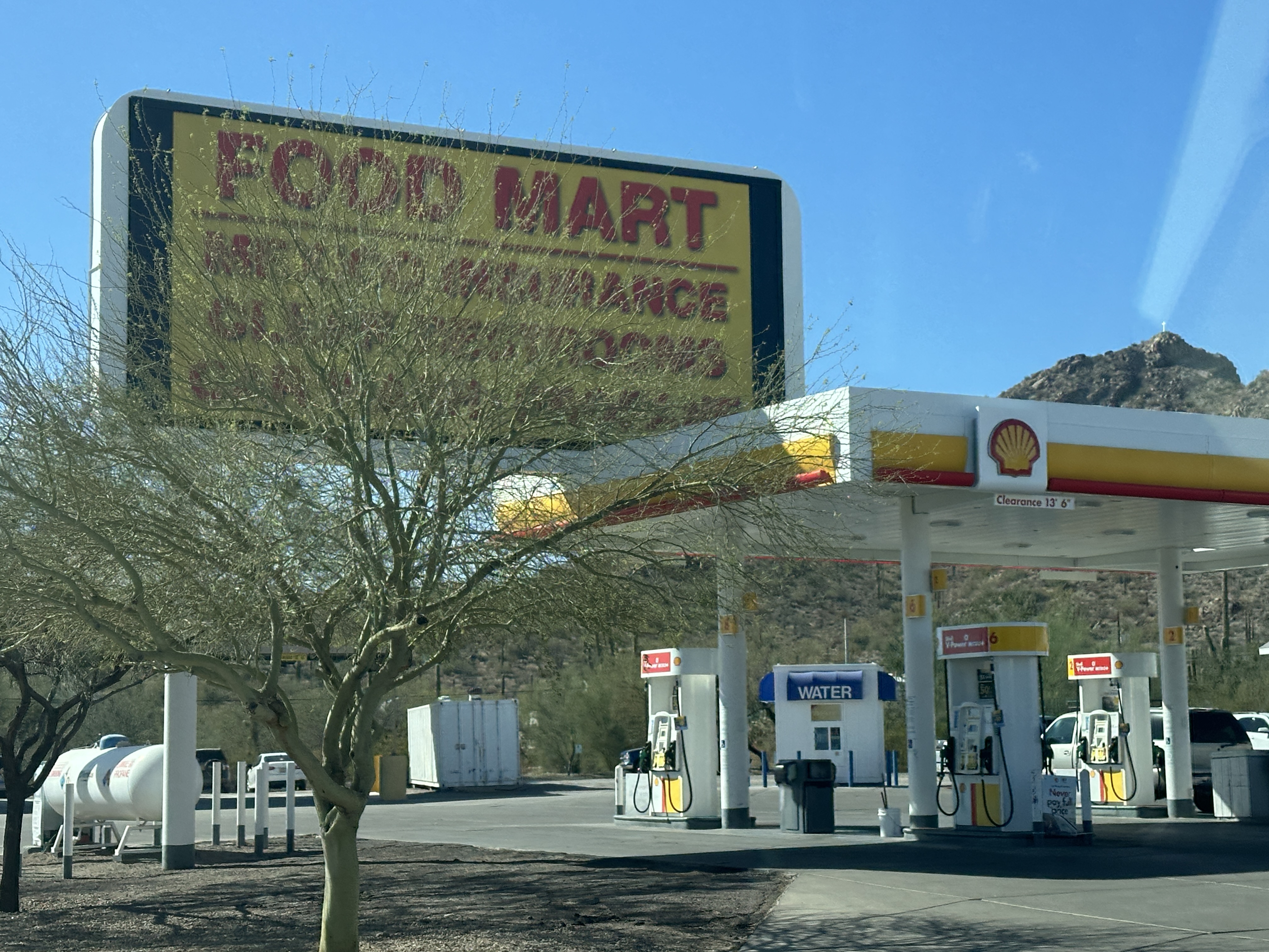
Onward to Gila Bend, where we stay at an Elks Lodge. But, only after checking out the town. Lunch at a fabulous taqueria and pottery shop is a great starting place.

I think this taqueria/pottery shop is actually the most scenic thing in Gila Bend! Nary a grocery store other than the Dollar General at one end of town, the Food Mart at the gas station, plus a small mercado where we bought some candied sweet potatoes (yum!). We were glad to have a decent supply of fresh vegetables with us, since there was little to choose from here.
At the Elks Lodge, we met up with a number of local folks and had a chat about how this area used to be much greener until they dammed the Gila River upstream. Now, in four years of drought, they are watching even the cactus start to die out. We also learned that this area has a "monsoon season", which occurs in July and August, where flash flooding is a regular occurrence. The roads here all have dips in them about every mile or so, with signs warning to "watch for flash floods' and "do not enter this area if flooded." We could just see people sitting in their trucks on the higher ground, waiting for the water to dissipate from the dips in the road, as the water disperses and sinks into the playa. I would like to see this area perhaps after the monsoon season, as I'm sure the flora is incredibly different than what we see across the playa today.


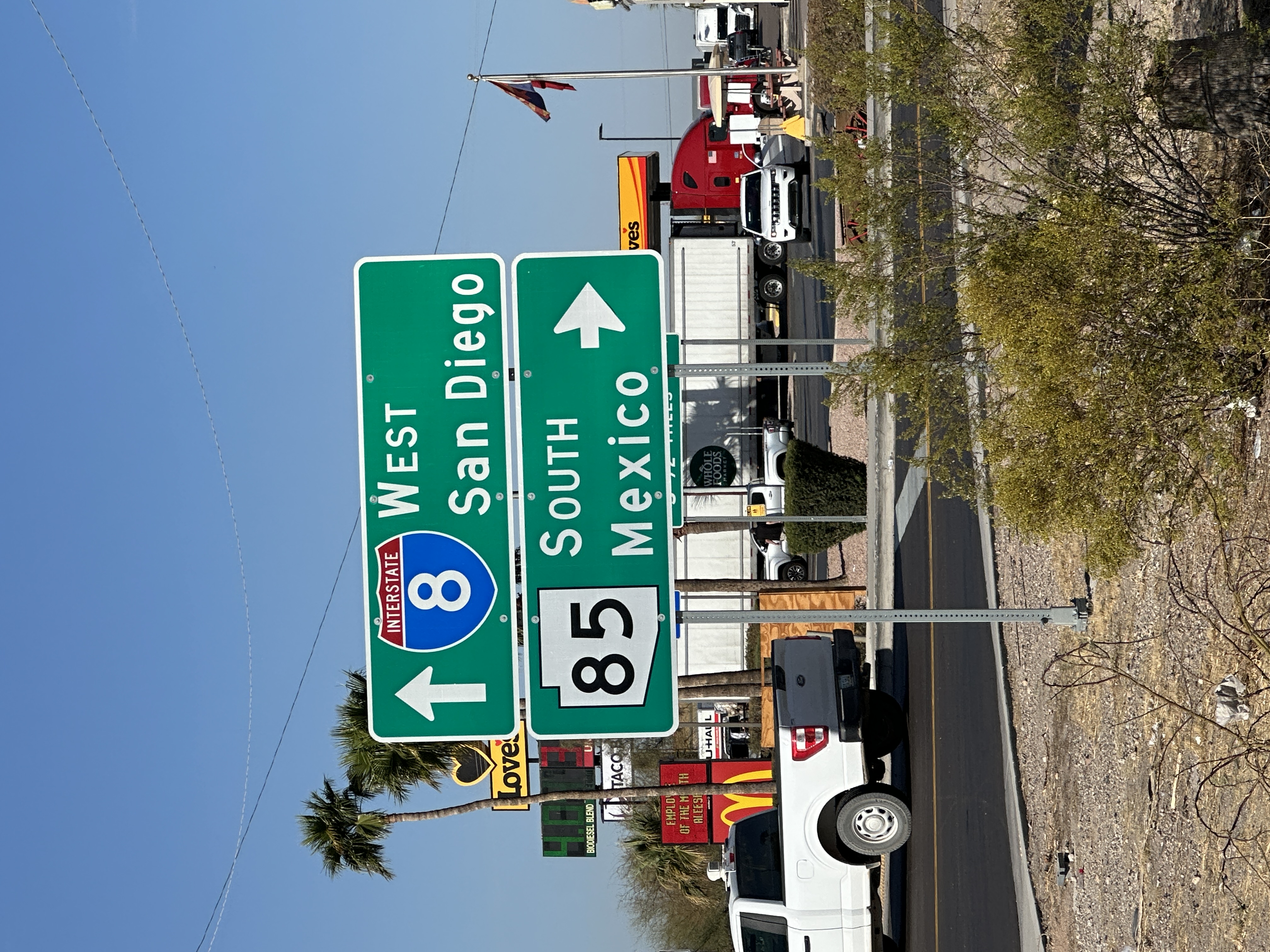
I always love the exhilaration of seeing road signs for border crossings on our road trips. It adds the thrill of adventure to the trip. We are really far from home.
Our route takes us southward, to Organ Pipe Cactus National
Monument. All the way there, we saw lots
of Saguaro cactus, so we’re looking forward to seeing what an Organ Pipe cactus
looks like.


As we pull into the National Monument Visitor Center, we are greeted by a group of protesters. Their signs are nearly too polite so we have to ask what they are protesting about. It all has to do with losing Park Rangers in the current federal employee sweep. We gave everyone our heartfelt support, and headed into the park.


There are still lots and lots of Saguaro cactus everywhere, but now we are also seeing the Organ Pipe cactus pop up into the landscape. We go for a 20-mile loop drive through the park, and take in the stunning beauty of this rugged topology and the flora that dare to grow in the harsh conditions.


A pickup truck passed us on the road. When we caught up with it ten minutes later, we met three women unloading a big barrel of water from the truck bed and placing it next to a table with a very tall blue flag attached. We stopped to chat with these women. They were setting out humanitarian stations, providing water for anyone that was traveling on foot through the desert.

Alas, an arch rock! And a trailhead! We pull over, put on our hiking boots, and head into the canyon.


The trail is a bit rocky, and eventually just goes up the solid rock walls of the canyon. This is where I stop and let Phil play mountain-goat the rest of the way up the canyon.

The campground in the park is designed to hold hundreds of campers. But even with the high density of campsites, it still feels like a wonderful desert village. We indulge in sitting out and just gazing off at the forest of Palos Verde trees (green trunks and branches, no leaves! They have chlorophyll in the bark, and can process photosynthesis without leaves. Amazing!) and occasional cacti.


As we stare at the sky, we hear piano music playing. We walk over to the amphitheater, and there is a pianist performing on the stage. Amazing! Looking up at the sky, watching the Milky Way form above us, listening to live piano music in near darkness, surrounded by silhouettes of cactus and mesquite and the sweet smell of the desert. Delightful! Then, to cap it off, after the pianist completed the performance, the announcers let us know that the local astronomy club had set up five telescope stations around the back row at the amphitheater, and we could go to each one for a close-up look at Jupiter, Venus, Mars, the Orion Nebula, and Pleiades Seven Sisters. This evening couldn’t have been more wonderful.
3/1/25
Today, we are going to drive along the southern US border,
still inside the National Monument. I’m
a little nervous about hanging out right there at the border fence, as the park
rangers told us if we wanted to drive on the Puerto Blanco border road, to be
prepared to be stopped and have our vehicles searched if the Border Patrol deem
it necessary. There is a border crossing
in Lukeville, just a few miles east of the park. There are signs everywhere warning us to
avoid “immigration activity” and don’t pick up hitchhikers. Phil is all gung-ho, ready for an adventure,
and being a geographer, he gets a thrill being this close to a political
boundary that otherwise are experienced as just thick lines on the map. So, against my better judgement, we head out
to the border, and bump along the Puerto Blanco for 15 miles.


We pass three separate humanitarian stations along the road. It must be very perplexing to anyone standing on the Mexico side of the wall, knowing that they are not welcome to cross without papers, but if they somehow make it across, there is a water station there, waiting for them. It is such a complicated world we live in.

The Border Patrol don’t seem to be concerned that we are harboring anyone in our van. They pass by and offer a friendly wave to us. It must be a quiet day at the border today.
On the way back to camp, we drive down to Lukesville, just
to see what the border crossing looks like.
This is a small crossing. Additional
to the checkpoint lanes, there is a gas station, a few Mexico Travel Insurance
offices, a shuttle/private bus service pickup area, a restaurant, and that’s
just about everything that’s here. Everyone that is here seems to be having a
normal, very ordinary day. I am probably
the only one who is looking around, watching for a break-away and car chase to
pop out of nowhere. I watch too much
tv. Chill out Deb!


Back at the campground, we filled our water supply tank, so
that we could take as leisurely a shower as one can imagine in our tiny
bathroom. The sunset was amazing this
evening! What a beautiful view for the
close of the day.


3/3/25
Today we are heading to Kitt Peak National Observatory, just
west of Tucson. Phil has been following
the telescope development at Kitt Peak since he was a kid, so this is a real
treat, a dream come true to visit in-person.
We are scheduled for a tour at 10am, and it’s nearly three hours drive
from Organ Pipe Catus Nat’l Monument, so we’re up really early today, hitting
the road before sunrise to get there in time for the tour. This is the first day that we are awake to
greet the sunrise.

We stopped in Why to get gas. I couldn’t resist snapping a pic of the
roadside stop across the street, called “Why Not”. What a name for a town!


The road up Kitt Peak is pretty steep, but we relax knowing that big trucks had to get up this road to carry telescope equipment, so surely the road is wide enough and hardy enough for us to pass easily. Still, there is a lot of steep, curvy sections with cliff-like drop-offs, an adventure just getting up the mountain.


And, finally, we are there at the top. With plenty of time to make the tour. We took three tours today, seeing four of the main telescopes and hearing other fact-filled stories about the development and usage of each of the telescopes, the history of the National Observatory, and what’s currently happening and who’s using all the equipment currently. Lots of scientific breakthroughs happened here; it was exciting hearing about it.


Kitt Peak falls within the land of the Tohono O’odham Native
Americans. When the founders requested
access to the mountain top, the Tohono O’odham gave them a lease in perpetuity
to use the space, but under the agreement that there would be no military
activity, no guns or rockets of any kind, and no commercial development on the
property. With that, the campus is
really sparse of standard accommodations for visitors. There are dormitories where scientists can
stay, and nothing is very fancy or polished.
You can buy a candy bar or a sandwich and a soda in the visiter center
gift shop, but that was it. With our
tours, we were able to order sandwich lunches, because again there is no
cafeteria or restaurant for visiters. The gift shop included just a few
observatory-related items such as posters and t-shirts. But, nicely enough, the shelves and display
cases were more then 50% dedicated to hand-made products of the Tohono O’odham. Throughout the Visiter Center and around the
campus, there was lots of reminders that we were walking on hallowed ground of
the O’odham. Fair enough!


The large 4-meter telescope is the prominent structure at the front of the mountain. It has an observation deck all the way around it. We could have stayed in the deck for days, just gazing out at the 360-degree view of the landscape and the clouds. The most popular telescope is the odd-shaped one that looks like a “7” lying on the ground. It is not currently In use, but they are refurbishing it to be part of their educational program. Speaking of educational program, they had a spherical projector system that they could study both the surface of the earth or any other spherical celestial body, including the sun. Amazing to be there, watching this in 3-d!


The Visitor Center had lots of very cool exhibits that we played with and thoroughly enjoyed.


At the end of the day, it was time to head down, down, down. We watched the clouds form across the landscape on our descent. Lots of Vira (rain that never touches the ground).


Finally, we arrive in Tucson.

3/4/25
We are going to spend a few days here in Tucson, as we are anxious to get to know this growing city. After staying in the Elks Club parking lot for the first night, we head toward Willcox, then south to Soniota. Along the way, we see a sign for “Oak Valley”. We haven’t seen an oak tree for a thousand miles, so our attention was perked. Sure enough, we cross one ridge, and there are waves of low hills, lined with oak trees!

To our amazement, we start seeing signs for wineries coming up on our route. What is this?? We are starting to feel like we’ve been transported back to the San Francisco Bay Area, with rolling grassy hills polka-dotted with oak trees, and wineries inviting us for tastings. We are intrigued.


We stop at the Rune Winery, as our curiosity is perked. They were open for tasting (at 10am on a
Tuesday, no less!). We met Edward at the
tasting bar and inundated him with questions.
The vineyards for the Rune winery are mostly in the Willcox area, one
hill over to the east. Their wines were
more of Italian varietals, so there was no direct comparison with the Sonoma
Cabernets to which we were accustomed.
Although the area was predominantly more arid than the California
growing regions, they relied on late-summer monsoons every year for their
crops. I never knew that there were
regular monsoon season in the Arizona desert!
I always assumed that all of the arid states got their rain in the
winter months, just like California. We
are learning so much on this trip!


We tasted two wines, and bought two bottles of the most spectacular red "Graciano". Almost creamy, robust but soft around the edges, full of flavor without being fruity, oh my, this was fabulous. We promised ourselves that these bottles would be stashed deep in the cabinets so that they would make it all the way home intact.
We continued our drive southward, with our destination being
a Forest Service campground in the Coronado National Forest, just north of the
US border, south of Sierra Vista. The
terrain was starting to look very arid again; no more oak trees or wineries. We
drive through Sierra Vista just to see what this town looks like. There doesn’t seem to be a central town
center, more just a few parallel streets that run for miles, lined with
shopping centers.
Finally, we reach the Coronado National Forest. To our disappointment, all the campgrounds
are still closed for the season! We drive
back up to the Forest Service/BLM joint office in Sierra Vista, and ask about
alternatives. The woman we talked with
(I’m not exactly sure if she was a ranger or not, as she didn’t have a uniform
on) was a bit non-plussed to help us with our quest, as it seemed that she was
busy with general stuff and phonecalls
from locals reporting in suspicious activities. Phil and I just took a minute and looked
around this office. The front door was
locked, and to get in, you had to ring the bell. Once inside, the greeting area was large and
polished and welcoming. But, this
woman’s desk that she returned to after she figured she couldn’t help us
anymore since the campgrounds were closed, it was behind a floor-to-ceiling
sheet of bullet-proof plexiglass. We
then talked with her through a metal grate in front of her desk, asking what
the sheet was all about. She said they
put it in and had to start locking the door because there were often car chases
down the street heading northward, and they didn’t want to invite any trouble
with illegal chase participants looking for a place to hide or cause
trouble. Yikes.
This area did not sound inviting for boondocking after that
conversation. So, we checked our maps,
and found a few State and County parks that had campgrounds. Patagonia Lake State Park had one campsite
open. Yay! We couldn’t reserve it because they won’t
reserve anything after the clock ticked as same-day as your arrival time. At that point, all available campsites go to
first-come-first-serve status. It was an
hour’s drive to get there, but we got our good-luck mojo on and headed to
Patagonia.
The terrain was beautiful! It was feeling more and more inviting as the road took us into the beautiful rolling hills.

When we arrived, we found that the campsite was still available, so we settled in. It was even available the next night too, and I was able to reserve it for the next day since we were planning now a day ahead.

Patagonia Lake is a bird sanctuary. Everyone that was camped here was a birding
enthusiast. We would be walking to the
check-in station and people would pass us, asking what birds did we spot
today. We covered our ignorance by
saying that we had just arrived, so we hadn’t seen any yet (that was actually
true alas). But we thought we might
brush up on at least some of the most common birds that we might try to
identify while we were here. There were tons of birds right in the campground, near the feeders at the ranger station, and hanging out in trees and on telephone lines.


3/5/25
Now, a whole extra day here at Patagonia Lake, we enjoy our lakeside campsite with a slow breakfast. Then, we go for a walk on one of the many trails wrapping the lake. There are reeds and thickets wrapping the shoreline, then the cactus takes over as you move up the embankment.


We bought a half-dozen tamales from a vendor sitting out front of the grocery store. His wife, who is Filipino, learned to cook them from her mother-in-law. They were absolutely delicious.


But, with over an hour and a half wait-time for a table, we settled for another option. Fortunately, while Phil was waiting for me in the museum gift shop, he read a few pages from a book there called, "The 500 Things You Must Do in Tucson Before You Die". It said that you Must have tacos at "Boca Cafe". Well, that was intriguing enough. It hadn't mentioned El Charro in the book, so Boca must really be something to write home about. I called them, and they said there was no wait, just come by and they'd seat us.


3/7/25 We spent the night at the Elks Lodge again. This is becoming like returning home; we are getting used to the neighborhood there! Today, we wake up to huge raindrops pounding on the roof of our van. It's really pouring today, and a bit windy too. First thing on our agenda today is a little TLC for the van. So, off to a Jiffy Lube for an oil change. Things are slow here now due to the weather, so all four of the attendees catered to our Lexy. They were all very friendly, and efficient. We were off again within a half hour, all refreshed, oiled and lubed.


The landscape becomes full with desert plants. I can't really use the word "lush" because everything has thorns and spikes on every surface.


Robin calls and lets us know how lucky we were to have left when we did, because it is now pouring cats and dogs up in Kingman, and the I-40 pass would have been a nightmare to traverse in this storm. Glad that was behind us! The storm had hit us overnight while we were parked in Bakersfield, thank goodness. There is a freshness in the air, and things are getting greener as we head westward. There are still rainclouds on the horizon as we hit I-5 and head northward, and we pass through a few short downpours, but it's otherwise a gorgeous day here in the Valley.


No comments:
Post a Comment