
This is a trip where we get to stop and visit all the local places that we have wanted to visit for years but never got there. How rich!
Our first stop northward was at the petrified forest, off Mark West Springs Road. What a delightful little park!


The silica from the volcanic ash was the main ingredient for the wood becoming petrified.


We cross into the watershed and head downhill, and then into Kelseyville. We stopped for a bottle of wine, and then headed back to our turn, and were waved to the side of the road by Daniel, a local traveler, missing his front two teeth. Seems he just wanted to greet people as they came into town. He warned us that the raccoons in the area knew how to open zippers, so beware if we were camping. We thanked him, and then went on our way.
And, alas we pull into the Clear Lake State Park, and find our spot #63. It is right on the lake. Just what the doctor ordered!

Porthos is anxious because he senses the raccoons looming, waiting for us to go inside so they can clean up our campsite. We tidy up so they don't score a bag of cookies at our site.
Next day, we do absolutely nothing! Walking down to the lake shore was a mere 50 ft trek, so we walked it many times, just to go watch birds skimming the water's surface. Loons, geese, and others, it was a busy waterway for the day and well into the night. And on land, the biggest crows and lots of rapters floating and squawking overhead. This is a bird haven, and it is marvelous.
We muster ourselves up for a walk around the park, and head out along the shoreline going eastward. There is an established swimming beach in the park.

We check out neighboring campsite loops, and mark a few spots where we might venture to stay next time. The upper loop was closed for the season, but the campsites sit high above the lake with beautiful vistas.


Well, the battery tested okay, so now it's an ignition problem? We couldn't figure how a jump helped if it wasn't a battery issue, but go figure. While mulling it over with the Napa Parts crew, a customer, George joined the conversation and said he was a wizard at mechanics, he'd have a look for us. What a hoot!! He helped us diagnose, or at least learn about all the checkpoints on the electrical system, all while learning about his motorcycle accident, his hole in his skull and deaf ear, his complete auto mechanics shop of tools in the hatch-back of his Peugeot, particularly his 10mm wrenchs that always disappear, so he carries 2 just in case ('cause that size fits everything). And, lo and behold, he wiggled something, and the problem went away. We asked what it was, and he said," oh, maybe some dirt came off on a wire i touched, maybe you didn't tap the brake pedal gently enough, maybe your car didn't think it was in "park", I donno." Lol! So Phil took him inside and bought all the items George had initially planned to buy in the shop for him, and we headed out for a long drive around the lake, to super-charge the battery, and to practice our new ritual for starting the engine. Clap our hands three times, lightly touch the brake, and gingerly turn on the ignition. When turning it off, delicately move the shift into Park and make sure the P is lit up before turning off the key. I hope this gets us all the way home!
Driving around Clear Lake, the north side feels a little like a place that society forgot. There are little trailer parks and old little houses scattered around the north shore, and people just sort-of hanging out, watching the clouds go by. Not really any place to pull in for a meal, or point of interest, that was open anyway. Also, the lake level was very low, which added a certain eeriness to the hamlets lining the lake. All of the private houses had their own docks attached to the back porches, that now stuck up looking like fire lookout platforms rather than boat docks. Something was in low supply in the area: with water levels low, the economy was also slumping a bit. Nowhere to launch a boat, concern for high algae counts in the lake due to the concentration and higher temperature of the water body.....people just weren't heading to the lake right now.

We continued our lake loop through Lower Lake, into the older part of town. There was an Hispanic community that was prevalent, so we went into one grocery store looking for Herdez salsa (but alas, no luck, they didn't have this brand). We then found a wonderful, relatively new park in town right by the water, and got out of the van for a little stretch. It had a cool gym section of the park which I've never seen outdoors before, where they had weight machines and parcourse exercise machines for older kids to use. Cool! Like an outdoor gym, it was pretty nice. There were a bunch of teen boys there, working out and proably just having fun hanging out late on a school day.
Being that we now had an iffy problem to solve with our rv iginition, we decided shorten our trip to have our ignition checked out, and to get a new battery. So, we headed out in the morning.
Just outside the state park, we pulled into Peace & Plenty Farm. They were decorating the shop for harvest season, and we went inside.

At this time of year, the produce was limited to squashes, the last of the tomatoes and garlic, but they had a number of prepared items in jars like honey and pesto also. And, they had a little specialty of producing saffron. We purchased a bottle of saffron extract, and also a dozen corms to grow our own. This was quite educational; I did not know that saffron was in the crocus family. We got full instructions on how to plant, harvest, and maintain our saffron garden. We are excited.

We took an alternate route home, heading through Lower Lake, and came across a little barbeque place right on the main intersection in town. Wow, and it's lunch time! Perfect!

Heading through the Pope Valley, into Napa county was gorgeous. As we headed south through Napa county, the terrain transitioned from open country roads to more manicured properties, still rural of course, but you could tell we were moving into another environment, another demographic.

10/24/21 After a clean bill of health with our ignition system and a new chassis battery, we head back to Clear Lake to continue our trip. Of course, we have to take an alternate route northward, so we headed on highway 80 to Vacaville, took highway 505 north to the Berryessa exit at Winters. Winters, what a quaint little town! We drove through Main Street, enjoying the little shops within the 4-block downtown area, and then marveled at the victorian houses and bungalows on the west side of town. This is one town where we're going to stop and spend some time!
Onward to Lake Berryessa, we made our way north on the west shore, taking in the views of the rolling hills which turned to sharper and steeper slopes as we made our way northward. The entire area surrounding Lake Berryessa was burn-scorched from about two years ago. Black skeletal tree sticks rising from lower green brush and brown grass and occasional leafy outgrowth. It is as if the pheonix is still at rest, awaiting the return of its full form from the ashes.

We make our way northward to Putah Creek campground. Along the way, all the day-use spots are completely empty. It is Tuesday after all, at the end of October, so yeah, that makes sense. And, the water level is too low to launch a boat, so that with the surrounding hills being burned out, I guess this is not really the place where people flock to on a Tuesday. Lucky for us, we are basking in the space and silence, taking in this extraordinary place in its extreme state, beautiful and at rest.
Putah Creek Campground is run by the Royal Elk Park Management company, so it is actually a privately-managed site. We check in with the hosts, who are the only other campers in the entire establishment today. We have the pick of the place for camp spots, so we meander out to a stretch, just south of the boat launch peninsula. From there, we can see the major lake body of the lake to the left, and a minor inlet to the right.


We climb into our ride and head down the Berryessa-Knoxville Road, over toward Knoxville (a dot on the map), which guides us to Lower Lake and Clear Lake just beyond. The camp hosts say that this road is open and passable, just watch for a few rocks in the road. It's a 10-mile stretch to Knowxville, so okay, we're game. Right past the northern tip of Lake Berryessa, the road sign warns us of rough road ahead, and it narrows into nearly a one-lane road. Okay, we're still game. The scenery is beautiful, and obviously this is the road less traveled.

Onward to Lower Lake, and we timed it perfectly because it was lunch time, and so we pulled into that fabulous barbeque place we found last time. It's called, "Danny's Roadside Kitchen". I had a burger with glazed onions, bacon, and mushrooms, hold the bun! Phil got his favorite, the 1/4 rack of ribs. Fabulous! If you're traveling through, you might call ahead 'cause it takes 20 minutes for them to cook your order, but it's worth waiting for! It is take-out-only, but they have lovely picnic tables around the back. And, they take cash only (nice of them to have an atm just inside the door).


We then head up to Clear Lake State Park, and sure enough, our favorite spot is available (site 63). Home sweet home.

There is a sand bar that is formed just off the shore from our site, and it's full of pelicans.

The next morning, there was a dense fog over both land and water. There were a few brave souls out fishing.

We drove up to the trailhead and parked. There were only two other cars parked at the trailhead, so it looks like we nearly have the mountain to ourselves! Off we go.


Along the route, we passed through a lovely oak forest.

Continuing onward, we made it to the next two rest stops, and thought, let's go for the summit! And, Yay! We made it!


So glad we still got it in us to hike up tall hills! We'll just keep doing this as long as we can.


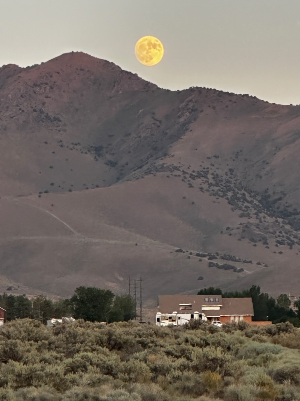
Back to the state park, through Kelseyville, and to a lovely evening, celebrating our "bagging a peak". Later in the evening as I was walking Porthos along the lake shore, I came across a beautiful plant that was covered with dew drops. I don't think the photo does it justice; it looked magical and bejeweled.

Along the way, we stop by Mendocino Lake. We pulled in the parking lot near the boat ramp that was closed for obvious reasons.


Onward, we pull into Calpella, and find Testa Winery. What a lovely setting, and a nice story of the Testa family that built the vinyard and winery.


No comments:
Post a Comment